Bazouges-la-Pérouse geodata
Bazouges-la-Pérouse (Brittany) is a populated place; located in France in Europe/Paris (GMT+2) time zone. With population of 1,849 people, there are 5127 cities with bigger population in this country. Compared to other cities in France, 66.8% of cities are located further ↓South; 92.8% of cities are located further →East and 59.1% of cities have higher elevation than Bazouges-la-Pérouse. Note1
Administrative division(s):
- Level 1: Brittany
- Level 2: Département d'Ille-et-Vilaine
- Level 3: Arrondissement de Fougères-Vitré
- Level 4: Bazouges-la-Pérouse


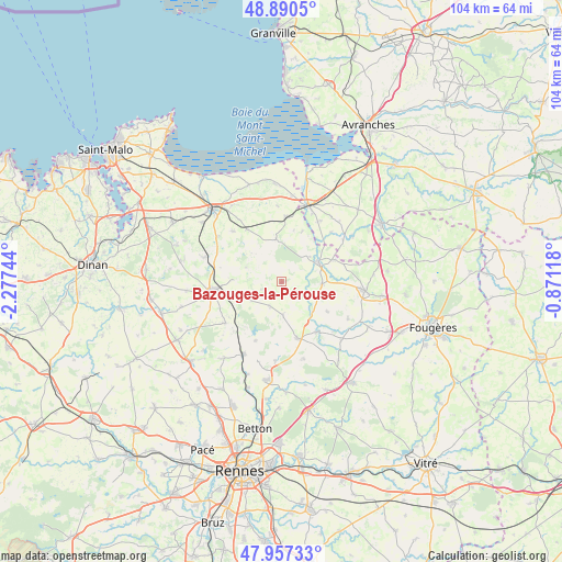
Bazouges-la-Pérouse GPS coordinates[2]
48° 25' 33.816" North, 1° 34' 27.516" West
| Map corner | latitude | longitude |
|---|---|---|
| Upper-left | 48.8905°, | -2.27744° |
| Center: | 48.42606°, | -1.57431° |
| Lower-right: | 47.95733°, | -0.87118° |
| Map W x H: | 103.8×103.8 km | = 64.5×64.5mi |
| max Lat: | 51.07786° ⇑33.2% North |
| Bazouges-la-Pérouse: | 48.42606° |
| min Lat: | ⇓66.8% South 41.3874° |
| min Long | Bazouges-la-Pé | max Long |
| -5.08615° | -1.57431° | 9.52242° |
| W 7.2%⇐ | ⇒92.8% E |
Elevation
Elevation of Bazouges-la-Pérouse is 105 m = 344 ft, and this is 88.7 m = 291 ft below average elevation for this country.
| Max E: |
2333 m = 7654 ft | 59.1% |
| Avg. | 193.7 m = 635 ft | |
| Bazouges-la-Pérouse | 105 m = 344 ft | |
Min E: |
-1 m = -3 ft | 40.9% |
See also: France elevation on elevation.city.
Geographical zone
Bazouges-la-Pérouse is located in North temperate zone (between Tropic of Cancer and the Arctic Circle). Distance of this North polar circle is 2016.7 km =1253.1 mi to North.| Distance of | km | miles | from Bazouges-la-Pérouse |
|---|---|---|---|
| North Pole | 4622.6 | 2872.3 | to North |
| Arctic Circle | 2016.7 | 1253.1 | to North |
| Tropic Cancer | 2778.6 | 1726.5 | to South |
| Equator | 5384.5 | 3345.8 | to South |


Nearby cities:
15 places around Bazouges-la-Pérouse: (largest is in red/bold)
• Antrain
7.7 km =4.8 mi,  60°
60°
• Chauvigné
10 km =6.2 mi,  123°
123°
• Combourg
12.6 km =7.8 mi,  263°
263°
• Epiniac
12.4 km =7.7 mi,  311°
311°
• Feins
11.9 km =7.4 mi,  204°
204°
• La Boussac
11.5 km =7.1 mi,  326°
326°
• La Fontenelle
6.9 km =4.3 mi,  49°
49°
• Marcillé-Raoul
5.2 km =3.2 mi,  206°
206°
• Pleine-Fougères
11.9 km =7.4 mi,  3°
3°
• Saint-Rémy-du-Plain
6.6 km =4.1 mi,  175°
175°
• Sens-de-Bretagne
10.8 km =6.7 mi,  164°
164°
• Sougéal
10.1 km =6.3 mi,  21°
21°
• Trans-la-Forêt
8.4 km =5.2 mi,  347°
347°
• Tremblay
7.3 km =4.5 mi,  93°
93°
• Vieux-Vy-sur-Couesnon
11.3 km =7 mi,  146°
146°
Sources, notices
• [Note1] Compared only with cities in France existing in our database
• [Src1] Map data: © OpenStreetMap contributors (CC-BY-SA)
• [Src2] Other city data from geonames.org with taken over terms of usage.
• [Src3] Geographical zone / Annual Mean Temperature by Robert A. Rohde @ Wikipedia
