Plappeville geodata
Plappeville (Grand Est) is a populated place; located in France in Europe/Paris (GMT+2) time zone. With population of 2,468 people, there are 3934 cities with bigger population in this country. Compared to other cities in France, 82.9% of cities are located further ↓South; 88.5% of cities are located further ←West and 73.2% of cities have lower elevation than Plappeville. Note1
Administrative division(s):
- Level 1: Grand Est
- Level 2: Moselle
- Level 3: Arrondissement de Metz
- Level 4: Plappeville


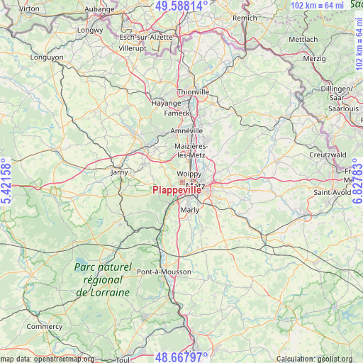
Plappeville GPS coordinates[2]
49° 7' 48.684" North, 6° 7' 28.956" East
| Map corner | latitude | longitude |
|---|---|---|
| Upper-left | 49.58814°, | 5.42158° |
| Center: | 49.13019°, | 6.12471° |
| Lower-right: | 48.66797°, | 6.82783° |
| Map W x H: | 102.3×102.3 km | = 63.6×63.6mi |
| max Lat: | 51.07786° ⇑17.1% North |
| Plappeville: | 49.13019° |
| min Lat: | ⇓82.9% South 41.3874° |
| min Long | Plappeville | max Long |
| -5.08615° | 6.12471° | 9.52242° |
| W 88.5%⇐ | ⇒11.5% E |
Elevation
Elevation of Plappeville is 237 m = 778 ft, and this is 43.3 m = 142 ft above average elevation for this country.
| Max E: |
2333 m = 7654 ft | 26.8% |
| Plappeville | 237 m 778 ft | |
| Avg. | 193.7 m = 635 ft | |
Min E: |
-1 m = -3 ft | 73.2% |
See also: France elevation on elevation.city.
Geographical zone
Plappeville is located in North temperate zone (between Tropic of Cancer and the Arctic Circle). Distance of this North polar circle is 1938.4 km =1204.5 mi to North.| Distance of | km | miles | from Plappeville |
|---|---|---|---|
| North Pole | 4544.3 | 2823.7 | to North |
| Arctic Circle | 1938.4 | 1204.5 | to North |
| Tropic Cancer | 2856.8 | 1775.1 | to South |
| Equator | 5462.8 | 3394.4 | to South |


Nearby cities:
15 places around Plappeville: (largest is in red/bold)
• Châtel-Saint-Germain
3.4 km =2.1 mi,  255°
255°
• Le Ban Saint-Martin
2.1 km =1.3 mi,  113°
113°
• Lessy
2.5 km =1.6 mi,  239°
239°
• Longeville-lès-Metz
2 km =1.2 mi,  155°
155°
• Metz
3.7 km =2.3 mi, 109°
• Montigny-lès-Metz
4.4 km =2.7 mi,  152°
152°
• Moulins-lès-Metz
3.1 km =1.9 mi,  202°
202°
• Norroy-le-Veneur
5.9 km =3.7 mi,  345°
345°
• Plesnois
5 km =3.1 mi,  344°
344°
• Rozérieulles
4.1 km =2.5 mi,  229°
229°
• Saint-Julien-lès-Metz
5.7 km =3.5 mi,  86°
86°
• Saulny
3.3 km =2.1 mi, 339°
• Scy-Chazelles
2 km =1.2 mi, 201°
• Vaux
4.9 km =3 mi,  213°
213°
• Woippy
3 km =1.9 mi,  39°
39°
Sources, notices
• [Note1] Compared only with cities in France existing in our database
• [Src1] Map data: © OpenStreetMap contributors (CC-BY-SA)
• [Src2] Other city data from geonames.org with taken over terms of usage.
• [Src3] Geographical zone / Annual Mean Temperature by Robert A. Rohde @ Wikipedia
