Saint-Julien-lès-Metz geodata
Saint-Julien-lès-Metz (Grand Est) is a populated place; located in France in Europe/Paris (GMT+2) time zone. With population of 3,228 people, there are 3025 cities with bigger population in this country. Compared to other cities in France, 83% of cities are located further ↓South; 89.3% of cities are located further ←West and 63.6% of cities have lower elevation than Saint-Julien-lès-Metz. Note1
Administrative division(s):
- Level 1: Grand Est
- Level 2: Moselle
- Level 3: Arrondissement de Metz
- Level 4: Saint-Julien-lès-Metz
Current local time in Saint-Julien-lès-Metz:
04:38 AM, WednesdayDifference from your time zone: hours


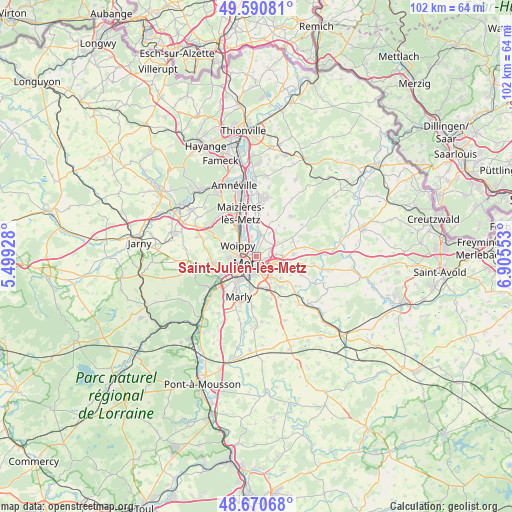
Saint-Julien-lès-Metz GPS coordinates[2]
49° 7' 58.368" North, 6° 12' 8.64" East
| Map corner | latitude | longitude |
|---|---|---|
| Upper-left | 49.59081°, | 5.49928° |
| Center: | 49.13288°, | 6.2024° |
| Lower-right: | 48.67068°, | 6.90553° |
| Map W x H: | 102.3×102.3 km | = 63.6×63.6mi |
| max Lat: | 51.07786° ⇑17% North |
| Saint-Julien-lès-Metz: | 49.13288° |
| min Lat: | ⇓83% South 41.3874° |
| min Long | Saint-Julien-l� | max Long |
| -5.08615° | 6.2024° | 9.52242° |
| W 89.3%⇐ | ⇒10.7% E |
Elevation
Elevation of Saint-Julien-lès-Metz is 187 m = 614 ft, and this is 6.7 m = 22 ft below average elevation for this country.
| Max E: |
2333 m = 7654 ft | 36.4% |
| Avg. | 193.7 m = 635 ft | |
| Saint-Julien-lès-Metz | 187 m = 614 ft | |
Min E: |
-1 m = -3 ft | 63.6% |
See also: France elevation on elevation.city.
Geographical zone
Saint-Julien-lès-Metz is located in North temperate zone (between Tropic of Cancer and the Arctic Circle). Distance of this North polar circle is 1938.1 km =1204.3 mi to North.| Distance of | km | miles | from Saint-Julien-lès-Metz |
|---|---|---|---|
| North Pole | 4544 | 2823.5 | to North |
| Arctic Circle | 1938.1 | 1204.3 | to North |
| Tropic Cancer | 2857.1 | 1775.3 | to South |
| Equator | 5463.1 | 3394.6 | to South |


Nearby cities:
15 places around Saint-Julien-lès-Metz: (largest is in red/bold)
• Argancy
7 km =4.3 mi,  359°
359°
• Ars-Laquenexy
6.6 km =4.1 mi,  131°
131°
• Charly-Oradour
5.3 km =3.3 mi,  29°
29°
• Failly
5.1 km =3.2 mi,  57°
57°
• La Maxe
4 km =2.5 mi,  346°
346°
• Le Ban Saint-Martin
3.9 km =2.4 mi,  252°
252°
• Longeville-lès-Metz
5.3 km =3.3 mi, 246°
• Metz
2.6 km =1.6 mi,  234°
234°
• Montigny-lès-Metz
5.5 km =3.4 mi,  221°
221°
• Noisseville
5.3 km =3.3 mi,  88°
88°
• Peltre
6.7 km =4.2 mi,  164°
164°
• Plappeville
5.7 km =3.5 mi,  266°
266°
• Scy-Chazelles
6.7 km =4.2 mi, 251°
• Vantoux
2.2 km =1.4 mi,  100°
100°
• Woippy
4.2 km =2.6 mi,  298°
298°
Sources, notices
• [Note1] Compared only with cities in France existing in our database
• [Src1] Map data: © OpenStreetMap contributors (CC-BY-SA)
• [Src2] Other city data from geonames.org with taken over terms of usage.
• [Src3] Geographical zone / Annual Mean Temperature by Robert A. Rohde @ Wikipedia
