Norroy-le-Veneur geodata
Norroy-le-Veneur (Grand Est) is a populated place; located in France in Europe/Paris (GMT+2) time zone. With population of 928 people, there are 9405 cities with bigger population in this country. Compared to other cities in France, 83.9% of cities are located further ↓South; 88.2% of cities are located further ←West and 75.9% of cities have lower elevation than Norroy-le-Veneur. Note1
Administrative division(s):
- Level 1: Grand Est
- Level 2: Moselle
- Level 3: Arrondissement de Metz
- Level 4: Norroy-le-Veneur


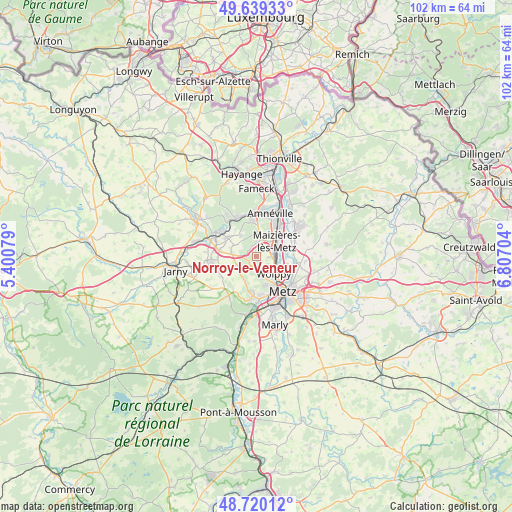
Norroy-le-Veneur GPS coordinates[2]
49° 10' 54.696" North, 6° 6' 14.076" East
| Map corner | latitude | longitude |
|---|---|---|
| Upper-left | 49.63933°, | 5.40079° |
| Center: | 49.18186°, | 6.10391° |
| Lower-right: | 48.72012°, | 6.80704° |
| Map W x H: | 102.2×102.2 km | = 63.5×63.5mi |
| max Lat: | 51.07786° ⇑16.1% North |
| Norroy-le-Veneur: | 49.18186° |
| min Lat: | ⇓83.9% South 41.3874° |
| min Long | Norroy-le-Veneu | max Long |
| -5.08615° | 6.10391° | 9.52242° |
| W 88.2%⇐ | ⇒11.8% E |
Elevation
Elevation of Norroy-le-Veneur is 256 m = 840 ft, and this is 62.3 m = 204 ft above average elevation for this country.
| Max E: |
2333 m = 7654 ft | 24.1% |
| Norroy-le-Veneur | 256 m 840 ft | |
| Avg. | 193.7 m = 635 ft | |
Min E: |
-1 m = -3 ft | 75.9% |
See also: France elevation on elevation.city.
Geographical zone
Norroy-le-Veneur is located in North temperate zone (between Tropic of Cancer and the Arctic Circle). Distance of this North polar circle is 1932.7 km =1200.9 mi to North.| Distance of | km | miles | from Norroy-le-Veneur |
|---|---|---|---|
| North Pole | 4538.6 | 2820.2 | to North |
| Arctic Circle | 1932.7 | 1200.9 | to North |
| Tropic Cancer | 2862.6 | 1778.7 | to South |
| Equator | 5468.5 | 3398 | to South |


Nearby cities:
15 places around Norroy-le-Veneur: (largest is in red/bold)
• Amanvillers
4.6 km =2.9 mi,  250°
250°
• Bronvaux
2 km =1.2 mi,  321°
321°
• Châtel-Saint-Germain
6.8 km =4.2 mi,  194°
194°
• Fèves
1.8 km =1.1 mi,  32°
32°
• La Maxe
6.4 km =4 mi,  103°
103°
• Maizières-lès-Metz
5.3 km =3.3 mi,  49°
49°
• Marange-Silvange
2.9 km =1.8 mi,  0°
0°
• Pierrevillers
4.8 km =3 mi,  359°
359°
• Plappeville
5.9 km =3.7 mi,  165°
165°
• Plesnois
1 km =0.6 mi, 171°
• Roncourt
5.1 km =3.2 mi,  296°
296°
• Saint-Privat-la-Montagne
4.8 km =3 mi,  277°
277°
• Saulny
2.7 km =1.7 mi, 171°
• Semécourt
2.8 km =1.7 mi,  60°
60°
• Woippy
4.9 km =3 mi,  134°
134°
Sources, notices
• [Note1] Compared only with cities in France existing in our database
• [Src1] Map data: © OpenStreetMap contributors (CC-BY-SA)
• [Src2] Other city data from geonames.org with taken over terms of usage.
• [Src3] Geographical zone / Annual Mean Temperature by Robert A. Rohde @ Wikipedia
