Pirey geodata
Pirey (Bourgogne-Franche-Comté) is a populated place; located in France in Europe/Paris (GMT+2) time zone. With population of 1,504 people, there are 6177 cities with bigger population in this country. Compared to other cities in France, 52.1% of cities are located further ↑North; 86.7% of cities are located further ←West and 80.8% of cities have lower elevation than Pirey. Note1
Administrative division(s):
- Level 1: Bourgogne-Franche-Comté
- Level 2: Doubs
- Level 3: Arrondissement de Besançon
- Level 4: Pirey


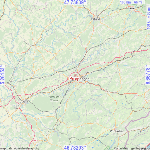
Pirey GPS coordinates[2]
47° 15' 40.896" North, 5° 57' 52.776" East
| Map corner | latitude | longitude |
|---|---|---|
| Upper-left | 47.73639°, | 5.26153° |
| Center: | 47.26136°, | 5.96466° |
| Lower-right: | 46.78203°, | 6.66778° |
| Map W x H: | 106.1×106.1 km | = 65.9×65.9mi |
| max Lat: | 51.07786° ⇑52.1% North |
| Pirey: | 47.26136° |
| min Lat: | ⇓47.9% South 41.3874° |
| min Long | Pirey | max Long |
| -5.08615° | 5.96466° | 9.52242° |
| W 86.7%⇐ | ⇒13.3% E |
Elevation
Elevation of Pirey is 299 m = 981 ft, and this is 105.3 m = 345 ft above average elevation for this country.
| Max E: |
2333 m = 7654 ft | 19.2% |
| Pirey | 299 m 981 ft | |
| Avg. | 193.7 m = 635 ft | |
Min E: |
-1 m = -3 ft | 80.8% |
See also: France elevation on elevation.city.
Geographical zone
Pirey is located in North temperate zone (between Tropic of Cancer and the Arctic Circle). Distance of this North polar circle is 2146.2 km =1333.6 mi to North.| Distance of | km | miles | from Pirey |
|---|---|---|---|
| North Pole | 4752.1 | 2952.8 | to North |
| Arctic Circle | 2146.2 | 1333.6 | to North |
| Tropic Cancer | 2649.1 | 1646.1 | to South |
| Equator | 5255 | 3265.3 | to South |


Nearby cities:
15 places around Pirey: (largest is in red/bold)
• Auxon-Dessous
4.4 km =2.7 mi,  345°
345°
• Auxon-Dessus
4 km =2.5 mi, 350°
• Avanne-Aveney
6.8 km =4.2 mi,  178°
178°
• Besançon
4.3 km =2.7 mi,  109°
109°
• Beure
6.8 km =4.2 mi,  153°
153°
• Chaucenne
5.6 km =3.5 mi,  296°
296°
• Chemaudin
6.8 km =4.2 mi,  231°
231°
• Châtillon-le-Duc
5.8 km =3.6 mi,  34°
34°
• Franois
4.4 km =2.7 mi,  218°
218°
• Geneuille
6.9 km =4.3 mi,  3°
3°
• Miserey-Salines
2.9 km =1.8 mi,  14°
14°
• Pelousey
3.5 km =2.2 mi, 296°
• Pouilley-les-Vignes
2.2 km =1.4 mi,  259°
259°
• Serre-les-Sapins
2.7 km =1.7 mi,  241°
241°
• École-Valentin
1.5 km =0.9 mi,  67°
67°
Sources, notices
• [Note1] Compared only with cities in France existing in our database
• [Src1] Map data: © OpenStreetMap contributors (CC-BY-SA)
• [Src2] Other city data from geonames.org with taken over terms of usage.
• [Src3] Geographical zone / Annual Mean Temperature by Robert A. Rohde @ Wikipedia
