École-Valentin geodata
École-Valentin (Bourgogne-Franche-Comté) is a populated place; located in France in Europe/Paris (GMT+2) time zone. With population of 2,295 people, there are 4205 cities with bigger population in this country. Compared to other cities in France, 52.1% of cities are located further ↑North; 86.9% of cities are located further ←West and 81% of cities have lower elevation than École-Valentin. Note1
Administrative division(s):
- Level 1: Bourgogne-Franche-Comté
- Level 2: Doubs
- Level 3: Arrondissement de Besançon
- Level 4: École-Valentin


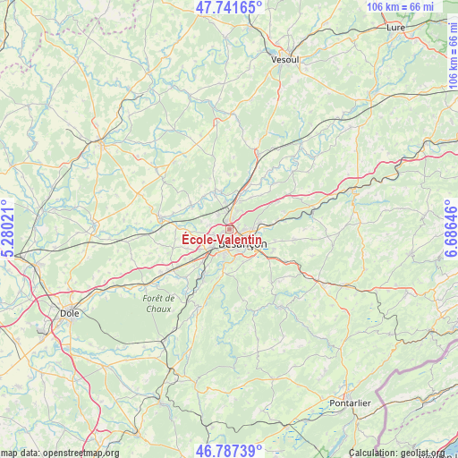
École-Valentin GPS coordinates[2]
47° 16' 0.012" North, 5° 58' 59.988" East
| Map corner | latitude | longitude |
|---|---|---|
| Upper-left | 47.74165°, | 5.28021° |
| Center: | 47.26667°, | 5.98333° |
| Lower-right: | 46.78739°, | 6.68646° |
| Map W x H: | 106.1×106.1 km | = 65.9×65.9mi |
| max Lat: | 51.07786° ⇑52.1% North |
| École-Valentin: | 47.26667° |
| min Lat: | ⇓47.9% South 41.3874° |
| min Long | École-Valentin | max Long |
| -5.08615° | 5.98333° | 9.52242° |
| W 86.9%⇐ | ⇒13.1% E |
Elevation
Elevation of École-Valentin is 300 m = 984 ft, and this is 106.3 m = 349 ft above average elevation for this country.
| Max E: |
2333 m = 7654 ft | 19% |
| École-Valentin | 300 m 984 ft | |
| Avg. | 193.7 m = 635 ft | |
Min E: |
-1 m = -3 ft | 81% |
See also: France elevation on elevation.city.
Geographical zone
École-Valentin is located in North temperate zone (between Tropic of Cancer and the Arctic Circle). Distance of this North polar circle is 2145.6 km =1333.2 mi to North.| Distance of | km | miles | from École-Valentin |
|---|---|---|---|
| North Pole | 4751.5 | 2952.4 | to North |
| Arctic Circle | 2145.6 | 1333.2 | to North |
| Tropic Cancer | 2649.6 | 1646.4 | to South |
| Equator | 5255.6 | 3265.7 | to South |


Nearby cities:
15 places around École-Valentin: (largest is in red/bold)
• Auxon-Dessous
4.5 km =2.8 mi,  325°
325°
• Auxon-Dessus
4 km =2.5 mi, 328°
• Besançon
3.3 km =2.1 mi,  127°
127°
• Beure
6.9 km =4.3 mi,  165°
165°
• Chalezeule
7 km =4.3 mi,  97°
97°
• Chaucenne
6.7 km =4.2 mi,  286°
286°
• Châtillon-le-Duc
4.6 km =2.9 mi,  23°
23°
• Devecey
6.7 km =4.2 mi, 23°
• Franois
5.8 km =3.6 mi,  225°
225°
• Geneuille
6.4 km =4 mi,  350°
350°
• Miserey-Salines
2.3 km =1.4 mi,  341°
341°
• Pelousey
4.7 km =2.9 mi,  281°
281°
• Pirey
1.5 km =0.9 mi,  247°
247°
• Pouilley-les-Vignes
3.7 km =2.3 mi, 254°
• Serre-les-Sapins
4.2 km =2.6 mi,  243°
243°
Sources, notices
• [Note1] Compared only with cities in France existing in our database
• [Src1] Map data: © OpenStreetMap contributors (CC-BY-SA)
• [Src2] Other city data from geonames.org with taken over terms of usage.
• [Src3] Geographical zone / Annual Mean Temperature by Robert A. Rohde @ Wikipedia
