Payns geodata
Payns (Grand Est) is a populated place; located in France in Europe/Paris (GMT+2) time zone. With population of 1,054 people, there are 8441 cities with bigger population in this country. Compared to other cities in France, 66% of cities are located further ↓South; 67.6% of cities are located further ←West and 64% of cities have higher elevation than Payns. Note1
Administrative division(s):
- Level 1: Grand Est
- Level 2: Département de l'Aube
- Level 3: Arrondissement de Troyes
- Level 4: Payns


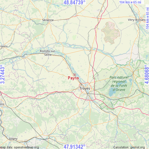
Payns GPS coordinates[2]
48° 22' 57.18" North, 3° 58' 39.18" East
| Map corner | latitude | longitude |
|---|---|---|
| Upper-left | 48.84739°, | 3.27443° |
| Center: | 48.38255°, | 3.97755° |
| Lower-right: | 47.91342°, | 4.68068° |
| Map W x H: | 103.8×103.8 km | = 64.5×64.5mi |
| max Lat: | 51.07786° ⇑34% North |
| Payns: | 48.38255° |
| min Lat: | ⇓66% South 41.3874° |
| min Long | Payns | max Long |
| -5.08615° | 3.97755° | 9.52242° |
| W 67.6%⇐ | ⇒32.4% E |
Elevation
Elevation of Payns is 92 m = 302 ft, and this is 101.7 m = 334 ft below average elevation for this country.
| Max E: |
2333 m = 7654 ft | 64% |
| Avg. | 193.7 m = 635 ft | |
| Payns | 92 m = 302 ft | |
Min E: |
-1 m = -3 ft | 36% |
See also: France elevation on elevation.city.
Geographical zone
Payns is located in North temperate zone (between Tropic of Cancer and the Arctic Circle). Distance of this North polar circle is 2021.5 km =1256.1 mi to North.| Distance of | km | miles | from Payns |
|---|---|---|---|
| North Pole | 4627.4 | 2875.3 | to North |
| Arctic Circle | 2021.5 | 1256.1 | to North |
| Tropic Cancer | 2773.7 | 1723.5 | to South |
| Equator | 5379.6 | 3342.7 | to South |


Nearby cities:
15 places around Payns: (largest is in red/bold)
• Barberey-Saint-Sulpice
6.4 km =4 mi,  140°
140°
• Fontaine-les-Grès
6.9 km =4.3 mi,  303°
303°
• La Chapelle-Saint-Luc
8.6 km =5.3 mi,  147°
147°
• La Rivière-de-Corps
10.9 km =6.8 mi,  163°
163°
• Les Noës-près-Troyes
10.1 km =6.3 mi, 150°
• Macey
11 km =6.8 mi,  204°
204°
• Mergey
2.3 km =1.4 mi,  83°
83°
• Pont-Sainte-Marie
11.2 km =7 mi,  129°
129°
• Saint-André-les-Vergers
12.1 km =7.5 mi, 153°
• Saint-Lyé
2.5 km =1.6 mi, 140°
• Saint-Mesmin
7.8 km =4.8 mi,  329°
329°
• Sainte-Maure
7.2 km =4.5 mi,  122°
122°
• Sainte-Savine
10.9 km =6.8 mi, 152°
• Savières
3.6 km =2.2 mi, 325°
• Troyes
12.1 km =7.5 mi, 138°
Sources, notices
• [Note1] Compared only with cities in France existing in our database
• [Src1] Map data: © OpenStreetMap contributors (CC-BY-SA)
• [Src2] Other city data from geonames.org with taken over terms of usage.
• [Src3] Geographical zone / Annual Mean Temperature by Robert A. Rohde @ Wikipedia
