Palau-del-Vidre geodata
Palau-del-Vidre (Occitanie) is a populated place; located in France in Europe/Paris (GMT+2) time zone. With population of 2,324 people, there are 4157 cities with bigger population in this country. Compared to other cities in France, 99.4% of cities are located further ↑North; 57.3% of cities are located further ←West and 92% of cities have higher elevation than Palau-del-Vidre. Note1
Administrative division(s):
- Level 1: Occitanie
- Level 2: Département des Pyrénées-Orientales
- Level 3: Arrondissement de Céret
- Level 4: Palau-del-Vidre


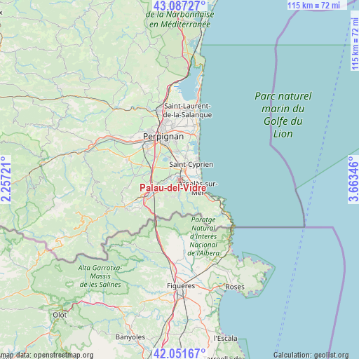
Palau-del-Vidre GPS coordinates[2]
42° 34' 17.832" North, 2° 57' 37.188" East
| Map corner | latitude | longitude |
|---|---|---|
| Upper-left | 43.08727°, | 2.25721° |
| Center: | 42.57162°, | 2.96033° |
| Lower-right: | 42.05167°, | 3.66346° |
| Map W x H: | 115.1×115.1 km | = 71.5×71.5mi |
| max Lat: | 51.07786° ⇑99.4% North |
| Palau-del-Vidre: | 42.57162° |
| min Lat: | ⇓0.6% South 41.3874° |
| min Long | Palau-del-Vidre | max Long |
| -5.08615° | 2.96033° | 9.52242° |
| W 57.3%⇐ | ⇒42.7% E |
Elevation
Elevation of Palau-del-Vidre is 25 m = 82 ft, and this is 168.7 m = 553 ft below average elevation for this country.
| Max E: |
2333 m = 7654 ft | 92% |
| Avg. | 193.7 m = 635 ft | |
| Palau-del-Vidre | 25 m = 82 ft | |
Min E: |
-1 m = -3 ft | 8% |
See also: France elevation on elevation.city.
Geographical zone
Palau-del-Vidre is located in North temperate zone (between Tropic of Cancer and the Arctic Circle). Distance of this Northern Tropic circle is 2127.6 km =1322 mi to South.| Distance of | km | miles | from Palau-del-Vidre |
|---|---|---|---|
| North Pole | 5273.5 | 3276.8 | to North |
| Arctic Circle | 2667.7 | 1657.6 | to North |
| Tropic Cancer | 2127.6 | 1322 | to South |
| Equator | 4733.5 | 2941.3 | to South |


Nearby cities:
15 places around Palau-del-Vidre: (largest is in red/bold)
• Alénya
7.7 km =4.8 mi,  13°
13°
• Argelers
5.8 km =3.6 mi,  118°
118°
• Bages
6.7 km =4.2 mi,  304°
304°
• Brouilla
4.7 km =2.9 mi,  263°
263°
• Corneilla-del-Vercol
5.9 km =3.7 mi,  353°
353°
• Elne
3.3 km =2.1 mi,  15°
15°
• Latour-Bas-Elne
5.2 km =3.2 mi,  41°
41°
• Montescot
4.5 km =2.8 mi,  330°
330°
• Ortaffa
2.9 km =1.8 mi,  288°
288°
• Saint-Génis-des-Fontaines
4.5 km =2.8 mi,  225°
225°
• Sant Andreu de Sureda
2.4 km =1.5 mi,  157°
157°
• Sorède
4.6 km =2.9 mi,  183°
183°
• Théza
7.4 km =4.6 mi, 354°
• Vilallonga dels Monts
6.9 km =4.3 mi,  221°
221°
• la Roca d'Albera
6 km =3.7 mi,  201°
201°
Sources, notices
• [Note1] Compared only with cities in France existing in our database
• [Src1] Map data: © OpenStreetMap contributors (CC-BY-SA)
• [Src2] Other city data from geonames.org with taken over terms of usage.
• [Src3] Geographical zone / Annual Mean Temperature by Robert A. Rohde @ Wikipedia
