Ornans geodata
Ornans (Bourgogne-Franche-Comté) is a populated place; located in France in Europe/Paris (GMT+2) time zone. With population of 4,235 people, there are 2324 cities with bigger population in this country. Compared to other cities in France, 54.1% of cities are located further ↑North; 88.7% of cities are located further ←West and 84.2% of cities have lower elevation than Ornans. Note1
Administrative division(s):
- Level 1: Bourgogne-Franche-Comté
- Level 2: Doubs
- Level 3: Arrondissement de Besançon
- Level 4: Ornans


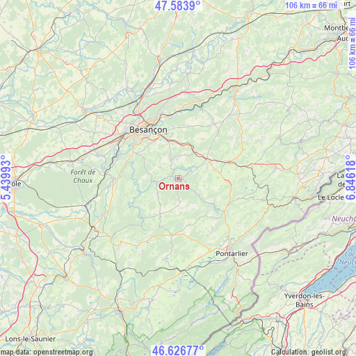
Ornans GPS coordinates[2]
47° 6' 26.964" North, 6° 8' 35.016" East
| Map corner | latitude | longitude |
|---|---|---|
| Upper-left | 47.5839°, | 5.43993° |
| Center: | 47.10749°, | 6.14306° |
| Lower-right: | 46.62677°, | 6.84618° |
| Map W x H: | 106.4×106.4 km | = 66.1×66.1mi |
| max Lat: | 51.07786° ⇑54.1% North |
| Ornans: | 47.10749° |
| min Lat: | ⇓45.9% South 41.3874° |
| min Long | Ornans | max Long |
| -5.08615° | 6.14306° | 9.52242° |
| W 88.7%⇐ | ⇒11.3% E |
Elevation
Elevation of Ornans is 337 m = 1106 ft, and this is 143.3 m = 470 ft above average elevation for this country.
| Max E: |
2333 m = 7654 ft | 15.8% |
| Ornans | 337 m 1106 ft | |
| Avg. | 193.7 m = 635 ft | |
Min E: |
-1 m = -3 ft | 84.2% |
See also: France elevation on elevation.city.
Geographical zone
Ornans is located in North temperate zone (between Tropic of Cancer and the Arctic Circle). Distance of this North polar circle is 2163.3 km =1344.2 mi to North.| Distance of | km | miles | from Ornans |
|---|---|---|---|
| North Pole | 4769.2 | 2963.4 | to North |
| Arctic Circle | 2163.3 | 1344.2 | to North |
| Tropic Cancer | 2631.9 | 1635.4 | to South |
| Equator | 5237.9 | 3254.7 | to South |


Nearby cities:
15 places around Ornans: (largest is in red/bold)
• Amancey
9.5 km =5.9 mi,  214°
214°
• Beure
15.2 km =9.4 mi,  316°
316°
• Chenecey-Buillon
14.4 km =8.9 mi,  284°
284°
• Fontain
13.5 km =8.4 mi, 318°
• Larnod
15.6 km =9.7 mi,  302°
302°
• Mamirolle
10.2 km =6.3 mi,  6°
6°
• Montfaucon
15 km =9.3 mi,  341°
341°
• Morre
14.1 km =8.8 mi, 338°
• Naisey-les-Granges
14.6 km =9.1 mi,  33°
33°
• Nancray
15.6 km =9.7 mi, 11°
• Pugey
14.4 km =8.9 mi,  306°
306°
• Saône
13 km =8.1 mi,  351°
351°
• Tarcenay
6 km =3.7 mi, 337°
• Vuillafans
7.2 km =4.5 mi,  130°
130°
• Étalans
11 km =6.8 mi,  63°
63°
Sources, notices
• [Note1] Compared only with cities in France existing in our database
• [Src1] Map data: © OpenStreetMap contributors (CC-BY-SA)
• [Src2] Other city data from geonames.org with taken over terms of usage.
• [Src3] Geographical zone / Annual Mean Temperature by Robert A. Rohde @ Wikipedia
