Étaves-et-Bocquiaux geodata
Étaves-et-Bocquiaux (Hauts-de-France) is a populated place; located in France in Europe/Paris (GMT+2) time zone. With population of 618 people, there are 13020 cities with bigger population in this country. Compared to other cities in France, 93.2% of cities are located further ↓South; 63.8% of cities are located further ←West and 55.3% of cities have lower elevation than Étaves-et-Bocquiaux. Note1
Administrative division(s):
- Level 1: Hauts-de-France
- Level 2: Département de l'Aisne
- Level 3: Arrondissement de Saint-Quentin
- Level 4: Étaves-et-Bocquiaux


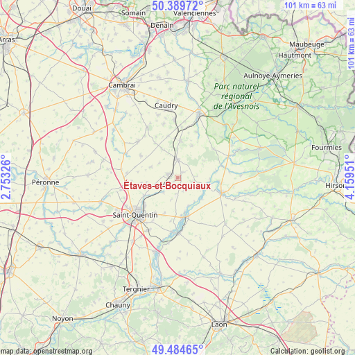
Étaves-et-Bocquiaux GPS coordinates[2]
49° 56' 21.516" North, 3° 27' 22.968" East
| Map corner | latitude | longitude |
|---|---|---|
| Upper-left | 50.38972°, | 2.75326° |
| Center: | 49.93931°, | 3.45638° |
| Lower-right: | 49.48465°, | 4.15951° |
| Map W x H: | 100.6×100.6 km | = 62.5×62.5mi |
| max Lat: | 51.07786° ⇑6.8% North |
| Étaves-et-Bocquiaux: | 49.93931° |
| min Lat: | ⇓93.2% South 41.3874° |
| min Long | Étaves-et-Bocq | max Long |
| -5.08615° | 3.45638° | 9.52242° |
| W 63.8%⇐ | ⇒36.2% E |
Elevation
Elevation of Étaves-et-Bocquiaux is 151 m = 495 ft, and this is 42.7 m = 140 ft below average elevation for this country.
| Max E: |
2333 m = 7654 ft | 44.7% |
| Avg. | 193.7 m = 635 ft | |
| Étaves-et-Bocquiaux | 151 m = 495 ft | |
Min E: |
-1 m = -3 ft | 55.3% |
See also: France elevation on elevation.city.
Geographical zone
Étaves-et-Bocquiaux is located in North temperate zone (between Tropic of Cancer and the Arctic Circle). Distance of this North polar circle is 1848.4 km =1148.5 mi to North.| Distance of | km | miles | from Étaves-et-Bocquiaux |
|---|---|---|---|
| North Pole | 4454.3 | 2767.8 | to North |
| Arctic Circle | 1848.4 | 1148.5 | to North |
| Tropic Cancer | 2946.8 | 1831.1 | to South |
| Equator | 5552.7 | 3450.3 | to South |


Nearby cities:
15 places around Étaves-et-Bocquiaux: (largest is in red/bold)
• Bohain-en-Vermandois
5.3 km =3.3 mi,  357°
357°
• Brancourt-le-Grand
6.7 km =4.2 mi,  307°
307°
• Busigny
10.6 km =6.6 mi,  4°
4°
• Fonsomme
5.9 km =3.7 mi,  222°
222°
• Fresnoy-le-Grand
2.9 km =1.8 mi,  288°
288°
• Homblières
11.9 km =7.4 mi,  213°
213°
• Lesdins
10.1 km =6.3 mi,  242°
242°
• Lesquielles-Saint-Germain
11.6 km =7.2 mi,  93°
93°
• Levergies
10.4 km =6.5 mi,  261°
261°
• Mennevret
8.8 km =5.5 mi,  53°
53°
• Montbrehain
8.2 km =5.1 mi, 291°
• Prémont
9.6 km =6 mi,  331°
331°
• Seboncourt
2 km =1.2 mi,  43°
43°
• Vadencourt
7.9 km =4.9 mi, 94°
• Vaux-Andigny
10.3 km =6.4 mi,  25°
25°
Sources, notices
• [Note1] Compared only with cities in France existing in our database
• [Src1] Map data: © OpenStreetMap contributors (CC-BY-SA)
• [Src2] Other city data from geonames.org with taken over terms of usage.
• [Src3] Geographical zone / Annual Mean Temperature by Robert A. Rohde @ Wikipedia
