Origny-le-Sec geodata
Origny-le-Sec (Grand Est) is a populated place; located in France in Europe/Paris (GMT+2) time zone. With population of 609 people, there are 13174 cities with bigger population in this country. Compared to other cities in France, 67.6% of cities are located further ↓South; 66.2% of cities are located further ←West and 63.2% of cities have higher elevation than Origny-le-Sec. Note1
Administrative division(s):
- Level 1: Grand Est
- Level 2: Département de l'Aube
- Level 3: Arrondissement de Nogent-sur-Seine
- Level 4: Origny-le-Sec


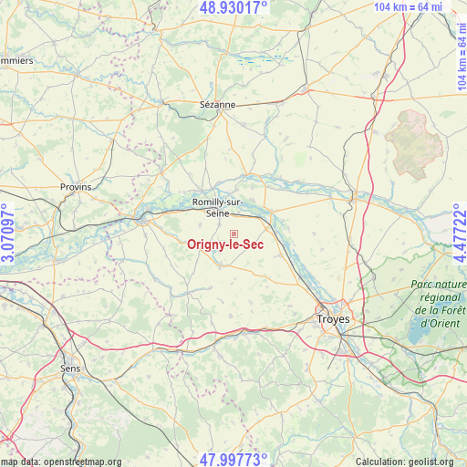
Origny-le-Sec GPS coordinates[2]
48° 27' 57.924" North, 3° 46' 26.76" East
| Map corner | latitude | longitude |
|---|---|---|
| Upper-left | 48.93017°, | 3.07097° |
| Center: | 48.46609°, | 3.7741° |
| Lower-right: | 47.99773°, | 4.47722° |
| Map W x H: | 103.7×103.7 km | = 64.4×64.4mi |
| max Lat: | 51.07786° ⇑32.4% North |
| Origny-le-Sec: | 48.46609° |
| min Lat: | ⇓67.6% South 41.3874° |
| min Long | Origny-le-Sec | max Long |
| -5.08615° | 3.7741° | 9.52242° |
| W 66.2%⇐ | ⇒33.8% E |
Elevation
Elevation of Origny-le-Sec is 94 m = 308 ft, and this is 99.7 m = 327 ft below average elevation for this country.
| Max E: |
2333 m = 7654 ft | 63.2% |
| Avg. | 193.7 m = 635 ft | |
| Origny-le-Sec | 94 m = 308 ft | |
Min E: |
-1 m = -3 ft | 36.8% |
See also: France elevation on elevation.city.
Geographical zone
Origny-le-Sec is located in North temperate zone (between Tropic of Cancer and the Arctic Circle). Distance of this North polar circle is 2012.3 km =1250.4 mi to North.| Distance of | km | miles | from Origny-le-Sec |
|---|---|---|---|
| North Pole | 4618.1 | 2869.6 | to North |
| Arctic Circle | 2012.3 | 1250.4 | to North |
| Tropic Cancer | 2783 | 1729.3 | to South |
| Equator | 5388.9 | 3348.5 | to South |


Nearby cities:
15 places around Origny-le-Sec: (largest is in red/bold)
• Châtres
6.7 km =4.2 mi,  54°
54°
• Clesles
8.7 km =5.4 mi,  29°
29°
• Conflans-sur-Seine
11.8 km =7.3 mi,  324°
324°
• Crancey
11.5 km =7.1 mi,  299°
299°
• Fontaine-les-Grès
10.8 km =6.7 mi,  120°
120°
• Gélannes
7.7 km =4.8 mi,  285°
285°
• Maizières-la-Grande-Paroisse
5 km =3.1 mi,  9°
9°
• Marcilly-sur-Seine
11.2 km =7 mi,  334°
334°
• Marigny-le-Châtel
7.6 km =4.7 mi,  201°
201°
• Méry-sur-Seine
9.9 km =6.2 mi,  60°
60°
• Ossey-les-Trois-Maisons
4.1 km =2.5 mi,  215°
215°
• Pars-lès-Romilly
3.9 km =2.4 mi, 304°
• Romilly-sur-Seine
6.1 km =3.8 mi, 324°
• Saint-Just-Sauvage
9.9 km =6.2 mi,  4°
4°
• Saint-Mesmin
11.4 km =7.1 mi,  102°
102°
Sources, notices
• [Note1] Compared only with cities in France existing in our database
• [Src1] Map data: © OpenStreetMap contributors (CC-BY-SA)
• [Src2] Other city data from geonames.org with taken over terms of usage.
• [Src3] Geographical zone / Annual Mean Temperature by Robert A. Rohde @ Wikipedia
