Maizières-la-Grande-Paroisse geodata
Maizières-la-Grande-Paroisse (Grand Est) is a populated place; located in France in Europe/Paris (GMT+2) time zone. With population of 1,549 people, there are 6016 cities with bigger population in this country. Compared to other cities in France, 68.5% of cities are located further ↓South; 66.2% of cities are located further ←West and 71.9% of cities have higher elevation than Maizières-la-Grande-Paroisse. Note1
Administrative division(s):
- Level 1: Grand Est
- Level 2: Département de l'Aube
- Level 3: Arrondissement de Nogent-sur-Seine
- Level 4: Maizières-la-Grande-Paroisse
Current local time in Maizières-la-Grande-Paroisse:
07:19 AM, SaturdayDifference from your time zone: hours


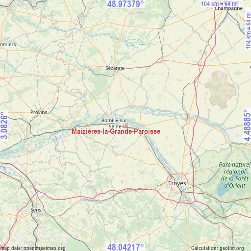
Maizières-la-Grande-Paroisse GPS coordinates[2]
48° 30' 36.432" North, 3° 47' 8.628" East
| Map corner | latitude | longitude |
|---|---|---|
| Upper-left | 48.97379°, | 3.0826° |
| Center: | 48.51012°, | 3.78573° |
| Lower-right: | 48.04217°, | 4.48885° |
| Map W x H: | 103.6×103.6 km | = 64.4×64.4mi |
| max Lat: | 51.07786° ⇑31.5% North |
| Maizières-la-Grande-Paroisse: | 48.51012° |
| min Lat: | ⇓68.5% South 41.3874° |
| min Long | Maizières-la-G | max Long |
| -5.08615° | 3.78573° | 9.52242° |
| W 66.2%⇐ | ⇒33.8% E |
Elevation
Elevation of Maizières-la-Grande-Paroisse is 74 m = 243 ft, and this is 119.7 m = 393 ft below average elevation for this country.
| Max E: |
2333 m = 7654 ft | 71.9% |
| Avg. | 193.7 m = 635 ft | |
| Maizières-la-Grande-Paroisse | 74 m = 243 ft | |
Min E: |
-1 m = -3 ft | 28.1% |
See also: France elevation on elevation.city.
Geographical zone
Maizières-la-Grande-Paroisse is located in North temperate zone (between Tropic of Cancer and the Arctic Circle). Distance of this North polar circle is 2007.4 km =1247.3 mi to North.| Distance of | km | miles | from Maizières-la-Grande-Paroisse |
|---|---|---|---|
| North Pole | 4613.2 | 2866.5 | to North |
| Arctic Circle | 2007.4 | 1247.3 | to North |
| Tropic Cancer | 2787.9 | 1732.3 | to South |
| Equator | 5393.8 | 3351.6 | to South |


Nearby cities:
15 places around Maizières-la-Grande-Paroisse: (largest is in red/bold)
• Anglure
8.7 km =5.4 mi,  13°
13°
• Châtres
4.7 km =2.9 mi,  102°
102°
• Clesles
4.3 km =2.7 mi,  52°
52°
• Conflans-sur-Seine
9.1 km =5.7 mi,  301°
301°
• Crancey
10.9 km =6.8 mi,  273°
273°
• Esclavolles-Lurey
10.6 km =6.6 mi, 296°
• Gélannes
8.8 km =5.5 mi,  250°
250°
• Marcilly-sur-Seine
7.7 km =4.8 mi,  312°
312°
• Marigny-le-Châtel
12.5 km =7.8 mi,  197°
197°
• Méry-sur-Seine
7.8 km =4.8 mi,  90°
90°
• Origny-le-Sec
5 km =3.1 mi,  189°
189°
• Ossey-les-Trois-Maisons
8.9 km =5.5 mi, 201°
• Pars-lès-Romilly
4.9 km =3 mi,  236°
236°
• Romilly-sur-Seine
4.4 km =2.7 mi, 271°
• Saint-Just-Sauvage
5 km =3.1 mi,  358°
358°
Sources, notices
• [Note1] Compared only with cities in France existing in our database
• [Src1] Map data: © OpenStreetMap contributors (CC-BY-SA)
• [Src2] Other city data from geonames.org with taken over terms of usage.
• [Src3] Geographical zone / Annual Mean Temperature by Robert A. Rohde @ Wikipedia
