Clesles geodata
Clesles (Grand Est) is a populated place; located in France in Europe/Paris (GMT+2) time zone. With population of 558 people, there are 14045 cities with bigger population in this country. Compared to other cities in France, 69.2% of cities are located further ↓South; 66.5% of cities are located further ←West and 69.7% of cities have higher elevation than Clesles. Note1
Administrative division(s):
- Level 1: Grand Est
- Level 2: Marne
- Level 3: Arrondissement d'Épernay
- Level 4: Clesles


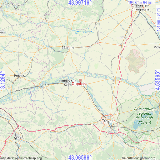
Clesles GPS coordinates[2]
48° 32' 1.32" North, 3° 49' 57.108" East
| Map corner | latitude | longitude |
|---|---|---|
| Upper-left | 48.99716°, | 3.1294° |
| Center: | 48.5337°, | 3.83253° |
| Lower-right: | 48.06596°, | 4.53565° |
| Map W x H: | 103.5×103.5 km | = 64.3×64.3mi |
| max Lat: | 51.07786° ⇑30.8% North |
| Clesles: | 48.5337° |
| min Lat: | ⇓69.2% South 41.3874° |
| min Long | Clesles | max Long |
| -5.08615° | 3.83253° | 9.52242° |
| W 66.5%⇐ | ⇒33.5% E |
Elevation
Elevation of Clesles is 79 m = 259 ft, and this is 114.7 m = 376 ft below average elevation for this country.
| Max E: |
2333 m = 7654 ft | 69.7% |
| Avg. | 193.7 m = 635 ft | |
| Clesles | 79 m = 259 ft | |
Min E: |
-1 m = -3 ft | 30.3% |
See also: France elevation on elevation.city.
Geographical zone
Clesles is located in North temperate zone (between Tropic of Cancer and the Arctic Circle). Distance of this North polar circle is 2004.7 km =1245.7 mi to North.| Distance of | km | miles | from Clesles |
|---|---|---|---|
| North Pole | 4610.6 | 2864.9 | to North |
| Arctic Circle | 2004.7 | 1245.7 | to North |
| Tropic Cancer | 2790.5 | 1733.9 | to South |
| Equator | 5396.4 | 3353.2 | to South |


Nearby cities:
15 places around Clesles: (largest is in red/bold)
• Anglure
6 km =3.7 mi,  346°
346°
• Châtres
3.8 km =2.4 mi,  162°
162°
• Conflans-sur-Seine
11.4 km =7.1 mi,  280°
280°
• Esclavolles-Lurey
13.1 km =8.1 mi, 279°
• Gélannes
13 km =8.1 mi,  244°
244°
• Maizières-la-Grande-Paroisse
4.3 km =2.7 mi,  232°
232°
• Marcilly-sur-Seine
9.5 km =5.9 mi,  286°
286°
• Méry-sur-Seine
5.1 km =3.2 mi,  122°
122°
• Origny-le-Sec
8.7 km =5.4 mi,  209°
209°
• Ossey-les-Trois-Maisons
12.8 km =8 mi, 211°
• Pars-lès-Romilly
9.2 km =5.7 mi, 234°
• Plancy-l'Abbaye
10.5 km =6.5 mi,  69°
69°
• Romilly-sur-Seine
8.2 km =5.1 mi,  252°
252°
• Saint-Just-Sauvage
4.2 km =2.6 mi,  303°
303°
• Saint-Mesmin
12.1 km =7.5 mi,  146°
146°
Sources, notices
• [Note1] Compared only with cities in France existing in our database
• [Src1] Map data: © OpenStreetMap contributors (CC-BY-SA)
• [Src2] Other city data from geonames.org with taken over terms of usage.
• [Src3] Geographical zone / Annual Mean Temperature by Robert A. Rohde @ Wikipedia
