Orgelet geodata
Orgelet (Bourgogne-Franche-Comté) is a populated place; located in France in Europe/Paris (GMT+2) time zone. With population of 1,752 people, there are 5410 cities with bigger population in this country. Compared to other cities in France, 60% of cities are located further ↑North; 83.8% of cities are located further ←West and 93.1% of cities have lower elevation than Orgelet. Note1
Administrative division(s):
- Level 1: Bourgogne-Franche-Comté
- Level 2: Jura
- Level 3: Arrondissement de Lons-le-Saunier
- Level 4: Orgelet


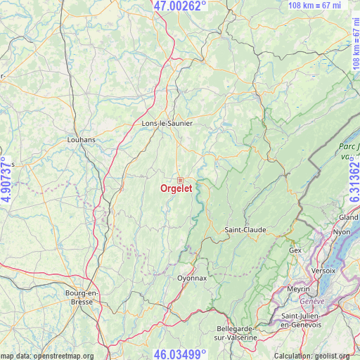
Orgelet GPS coordinates[2]
46° 31' 15.456" North, 5° 36' 37.764" East
| Map corner | latitude | longitude |
|---|---|---|
| Upper-left | 47.00262°, | 4.90737° |
| Center: | 46.52096°, | 5.61049° |
| Lower-right: | 46.03499°, | 6.31362° |
| Map W x H: | 107.6×107.6 km | = 66.9×66.9mi |
| max Lat: | 51.07786° ⇑60% North |
| Orgelet: | 46.52096° |
| min Lat: | ⇓40% South 41.3874° |
| min Long | Orgelet | max Long |
| -5.08615° | 5.61049° | 9.52242° |
| W 83.8%⇐ | ⇒16.2% E |
Elevation
Elevation of Orgelet is 507 m = 1663 ft, and this is 313.3 m = 1028 ft above average elevation for this country.
| Max E: |
2333 m = 7654 ft | 6.9% |
| Orgelet | 507 m 1663 ft | |
| Avg. | 193.7 m = 635 ft | |
Min E: |
-1 m = -3 ft | 93.1% |
See also: France elevation on elevation.city.
Geographical zone
Orgelet is located in North temperate zone (between Tropic of Cancer and the Arctic Circle). Distance of this North polar circle is 2228.5 km =1384.7 mi to North.| Distance of | km | miles | from Orgelet |
|---|---|---|---|
| North Pole | 4834.4 | 3004 | to North |
| Arctic Circle | 2228.5 | 1384.7 | to North |
| Tropic Cancer | 2566.7 | 1594.9 | to South |
| Equator | 5172.6 | 3214.1 | to South |


Nearby cities:
15 places around Orgelet: (largest is in red/bold)
• Arinthod
14.6 km =9.1 mi,  193°
193°
• Beaufort
14.4 km =8.9 mi,  294°
294°
• Clairvaux-les-Lacs
12.1 km =7.5 mi,  60°
60°
• Conliège
14.9 km =9.3 mi,  356°
356°
• Courbouzon
15.8 km =9.8 mi,  336°
336°
• Cousance
16.8 km =10.4 mi,  274°
274°
• Cuiseaux
17.2 km =10.7 mi,  260°
260°
• Gevingey
15.2 km =9.4 mi,  328°
328°
• Lons-le-Saunier
17.7 km =11 mi,  346°
346°
• Macornay
14.9 km =9.3 mi, 339°
• Messia-sur-Sorne
17.4 km =10.8 mi, 334°
• Moirans-en-Montagne
13.1 km =8.1 mi,  137°
137°
• Montaigu
15.7 km =9.8 mi, 347°
• Perrigny
16.4 km =10.2 mi, 353°
• Pont-de-Poitte
9.6 km =6 mi,  40°
40°
Sources, notices
• [Note1] Compared only with cities in France existing in our database
• [Src1] Map data: © OpenStreetMap contributors (CC-BY-SA)
• [Src2] Other city data from geonames.org with taken over terms of usage.
• [Src3] Geographical zone / Annual Mean Temperature by Robert A. Rohde @ Wikipedia
