Orbigny geodata
Orbigny (Centre) is a populated place; located in France in Europe/Paris (GMT+2) time zone. With population of 764 people, there are 11016 cities with bigger population in this country. Compared to other cities in France, 52.9% of cities are located further ↑North; 66.3% of cities are located further →East and 56.2% of cities have higher elevation than Orbigny. Note1
Administrative division(s):
- Level 1: Centre
- Level 2: Département d'Indre-et-Loire
- Level 3: Arrondissement de Loches
- Level 4: Orbigny


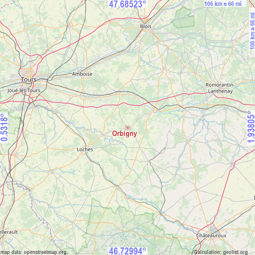
Orbigny GPS coordinates[2]
47° 12' 35.064" North, 1° 14' 5.748" East
| Map corner | latitude | longitude |
|---|---|---|
| Upper-left | 47.68523°, | 0.5318° |
| Center: | 47.20974°, | 1.23493° |
| Lower-right: | 46.72994°, | 1.93805° |
| Map W x H: | 106.2×106.2 km | = 66×66mi |
| max Lat: | 51.07786° ⇑52.9% North |
| Orbigny: | 47.20974° |
| min Lat: | ⇓47.1% South 41.3874° |
| min Long | Orbigny | max Long |
| -5.08615° | 1.23493° | 9.52242° |
| W 33.7%⇐ | ⇒66.3% E |
Elevation
Elevation of Orbigny is 113 m = 371 ft, and this is 80.7 m = 265 ft below average elevation for this country.
| Max E: |
2333 m = 7654 ft | 56.2% |
| Avg. | 193.7 m = 635 ft | |
| Orbigny | 113 m = 371 ft | |
Min E: |
-1 m = -3 ft | 43.8% |
See also: France elevation on elevation.city.
Geographical zone
Orbigny is located in North temperate zone (between Tropic of Cancer and the Arctic Circle). Distance of this North polar circle is 2151.9 km =1337.1 mi to North.| Distance of | km | miles | from Orbigny |
|---|---|---|---|
| North Pole | 4757.8 | 2956.4 | to North |
| Arctic Circle | 2151.9 | 1337.1 | to North |
| Tropic Cancer | 2643.3 | 1642.5 | to South |
| Equator | 5249.2 | 3261.7 | to South |


Nearby cities:
15 places around Orbigny: (largest is in red/bold)
• Angé
13.6 km =8.5 mi,  3°
3°
• Châteauvieux
11.4 km =7.1 mi,  78°
78°
• Faverolles-sur-Cher
12.4 km =7.7 mi,  344°
344°
• Genillé
10.6 km =6.6 mi,  253°
253°
• Loché-sur-Indrois
13.1 km =8.1 mi,  184°
184°
• Luzillé
14.4 km =8.9 mi,  294°
294°
• Mareuil-sur-Cher
11.7 km =7.3 mi,  37°
37°
• Nouans-les-Fontaines
9.5 km =5.9 mi,  149°
149°
• Noyers-sur-Cher
14.7 km =9.1 mi,  59°
59°
• Pouillé
12.7 km =7.9 mi,  19°
19°
• Saint-Aignan
12.5 km =7.8 mi, 58°
• Saint-Julien-de-Chédon
10.7 km =6.6 mi,  347°
347°
• Seigy
13.5 km =8.4 mi,  67°
67°
• Thésée
13.8 km =8.6 mi, 23°
• Villeloin-Coulangé
7.7 km =4.8 mi,  186°
186°
Sources, notices
• [Note1] Compared only with cities in France existing in our database
• [Src1] Map data: © OpenStreetMap contributors (CC-BY-SA)
• [Src2] Other city data from geonames.org with taken over terms of usage.
• [Src3] Geographical zone / Annual Mean Temperature by Robert A. Rohde @ Wikipedia
