Villeloin-Coulangé geodata
Villeloin-Coulangé (Centre) is a populated place; located in France in Europe/Paris (GMT+2) time zone. With population of 663 people, there are 12328 cities with bigger population in this country. Compared to other cities in France, 53.7% of cities are located further ↑North; 66.5% of cities are located further →East and 58.3% of cities have higher elevation than Villeloin-Coulangé. Note1
Administrative division(s):
- Level 1: Centre
- Level 2: Département d'Indre-et-Loire
- Level 3: Arrondissement de Loches
- Level 4: Villeloin-Coulangé


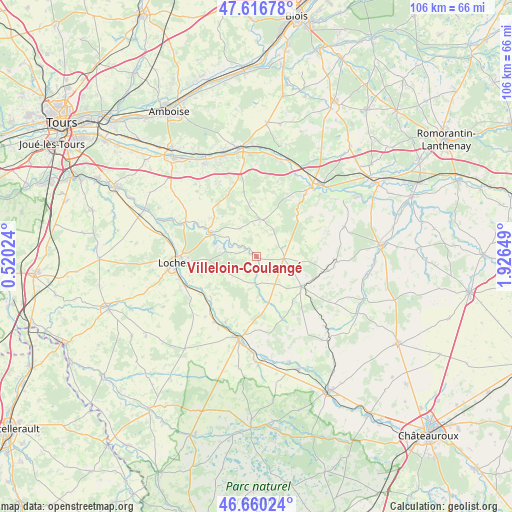
Villeloin-Coulangé GPS coordinates[2]
47° 8' 26.376" North, 1° 13' 24.096" East
| Map corner | latitude | longitude |
|---|---|---|
| Upper-left | 47.61678°, | 0.52024° |
| Center: | 47.14066°, | 1.22336° |
| Lower-right: | 46.66024°, | 1.92649° |
| Map W x H: | 106.4×106.4 km | = 66.1×66.1mi |
| max Lat: | 51.07786° ⇑53.7% North |
| Villeloin-Coulangé: | 47.14066° |
| min Lat: | ⇓46.3% South 41.3874° |
| min Long | Villeloin-Coula | max Long |
| -5.08615° | 1.22336° | 9.52242° |
| W 33.5%⇐ | ⇒66.5% E |
Elevation
Elevation of Villeloin-Coulangé is 107 m = 351 ft, and this is 86.7 m = 284 ft below average elevation for this country.
| Max E: |
2333 m = 7654 ft | 58.3% |
| Avg. | 193.7 m = 635 ft | |
| Villeloin-Coulangé | 107 m = 351 ft | |
Min E: |
-1 m = -3 ft | 41.7% |
See also: France elevation on elevation.city.
Geographical zone
Villeloin-Coulangé is located in North temperate zone (between Tropic of Cancer and the Arctic Circle). Distance of this North polar circle is 2159.6 km =1341.9 mi to North.| Distance of | km | miles | from Villeloin-Coulangé |
|---|---|---|---|
| North Pole | 4765.5 | 2961.1 | to North |
| Arctic Circle | 2159.6 | 1341.9 | to North |
| Tropic Cancer | 2635.6 | 1637.7 | to South |
| Equator | 5241.6 | 3257 | to South |


Nearby cities:
15 places around Villeloin-Coulangé: (largest is in red/bold)
• Beaulieu-lès-Loches
15.8 km =9.8 mi,  263°
263°
• Bridoré
16.4 km =10.2 mi,  220°
220°
• Châteauvieux
15.7 km =9.8 mi,  50°
50°
• Ferrière-sur-Beaulieu
14 km =8.7 mi,  268°
268°
• Fléré-la-Rivière
16 km =9.9 mi,  213°
213°
• Genillé
10.5 km =6.5 mi,  296°
296°
• Loché-sur-Indrois
5.4 km =3.4 mi,  182°
182°
• Luçay-le-Mâle
16.6 km =10.3 mi,  94°
94°
• Nouans-les-Fontaines
5.7 km =3.5 mi, 94°
• Orbigny
7.7 km =4.8 mi,  6°
6°
• Perrusson
16.5 km =10.3 mi,  253°
253°
• Saint-Hippolyte
13 km =8.1 mi,  225°
225°
• Saint-Jean-Saint-Germain
15.6 km =9.7 mi, 245°
• Verneuil-sur-Indre
16.8 km =10.4 mi,  235°
235°
• Écueillé
11.2 km =7 mi,  123°
123°
Sources, notices
• [Note1] Compared only with cities in France existing in our database
• [Src1] Map data: © OpenStreetMap contributors (CC-BY-SA)
• [Src2] Other city data from geonames.org with taken over terms of usage.
• [Src3] Geographical zone / Annual Mean Temperature by Robert A. Rohde @ Wikipedia
