Orbeil geodata
Orbeil (Auvergne-Rhône-Alpes) is a populated place; located in France in Europe/Paris (GMT+2) time zone. With population of 746 people, there are 11210 cities with bigger population in this country. Compared to other cities in France, 73.2% of cities are located further ↑North; 61.7% of cities are located further ←West and 90.9% of cities have lower elevation than Orbeil. Note1
Administrative division(s):
- Level 1: Auvergne-Rhône-Alpes
- Level 2: Département du Puy-de-Dôme
- Level 3: Issoire
- Level 4: Orbeil


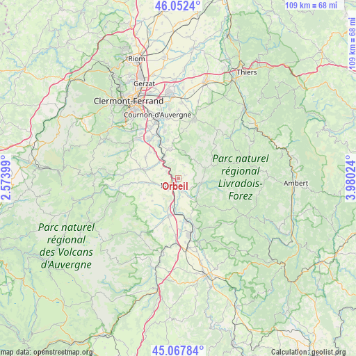
Orbeil GPS coordinates[2]
45° 33' 44.208" North, 3° 16' 37.632" East
| Map corner | latitude | longitude |
|---|---|---|
| Upper-left | 46.0524°, | 2.57399° |
| Center: | 45.56228°, | 3.27712° |
| Lower-right: | 45.06784°, | 3.98024° |
| Map W x H: | 109.5×109.5 km | = 68×68mi |
| max Lat: | 51.07786° ⇑73.2% North |
| Orbeil: | 45.56228° |
| min Lat: | ⇓26.8% South 41.3874° |
| min Long | Orbeil | max Long |
| -5.08615° | 3.27712° | 9.52242° |
| W 61.7%⇐ | ⇒38.3% E |
Elevation
Elevation of Orbeil is 448 m = 1470 ft, and this is 254.3 m = 834 ft above average elevation for this country.
| Max E: |
2333 m = 7654 ft | 9.1% |
| Orbeil | 448 m 1470 ft | |
| Avg. | 193.7 m = 635 ft | |
Min E: |
-1 m = -3 ft | 90.9% |
See also: France elevation on elevation.city.
Geographical zone
Orbeil is located in North temperate zone (between Tropic of Cancer and the Arctic Circle). Distance of this North polar circle is 2335.1 km =1451 mi to North.| Distance of | km | miles | from Orbeil |
|---|---|---|---|
| North Pole | 4941 | 3070.2 | to North |
| Arctic Circle | 2335.1 | 1451 | to North |
| Tropic Cancer | 2460.1 | 1528.6 | to South |
| Equator | 5066.1 | 3147.9 | to South |


Nearby cities:
15 places around Orbeil: (largest is in red/bold)
• Authezat
10.5 km =6.5 mi,  316°
316°
• Coudes
7.9 km =4.9 mi, 317°
• Issoire
3 km =1.9 mi,  227°
227°
• Lamontgie
10.7 km =6.6 mi,  155°
155°
• Le Breuil-sur-Couze
10.5 km =6.5 mi,  185°
185°
• Le Broc
7.3 km =4.5 mi,  200°
200°
• Neschers
9.4 km =5.8 mi,  289°
289°
• Parent
7.8 km =4.8 mi,  331°
331°
• Parentignat
3.3 km =2.1 mi, 161°
• Perrier
6.5 km =4 mi,  254°
254°
• Saint-Babel
4.2 km =2.6 mi,  24°
24°
• Sauxillanges
7.5 km =4.7 mi,  99°
99°
• Sugères
11.1 km =6.9 mi,  66°
66°
• Vic-le-Comte
9.3 km =5.8 mi,  344°
344°
• Yronde
5.9 km =3.7 mi, 343°
Sources, notices
• [Note1] Compared only with cities in France existing in our database
• [Src1] Map data: © OpenStreetMap contributors (CC-BY-SA)
• [Src2] Other city data from geonames.org with taken over terms of usage.
• [Src3] Geographical zone / Annual Mean Temperature by Robert A. Rohde @ Wikipedia
