Oletta geodata
Oletta (Corsica) is a populated place; located in France in Europe/Paris (GMT+2) time zone. With population of 1,335 people, there are 6877 cities with bigger population in this country. Compared to other cities in France, 99.2% of cities are located further ↑North; 99.8% of cities are located further ←West and 87.1% of cities have lower elevation than Oletta. Note1
Administrative division(s):
- Level 1: Corsica
- Level 2: Département de la Haute-Corse
- Level 3: Arrondissement de Calvi
- Level 4: Oletta


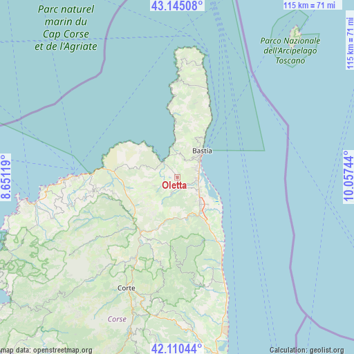
Oletta GPS coordinates[2]
42° 37' 47.676" North, 9° 21' 15.516" East
| Map corner | latitude | longitude |
|---|---|---|
| Upper-left | 43.14508°, | 8.65119° |
| Center: | 42.62991°, | 9.35431° |
| Lower-right: | 42.11044°, | 10.05744° |
| Map W x H: | 115×115 km | = 71.5×71.5mi |
| max Lat: | 51.07786° ⇑99.2% North |
| Oletta: | 42.62991° |
| min Lat: | ⇓0.8% South 41.3874° |
| min Long | Oletta | max Long |
| -5.08615° | 9.35431° | 9.52242° |
| W 99.8%⇐ | ⇒0.2% E |
Elevation
Elevation of Oletta is 376 m = 1234 ft, and this is 182.3 m = 598 ft above average elevation for this country.
| Max E: |
2333 m = 7654 ft | 12.9% |
| Oletta | 376 m 1234 ft | |
| Avg. | 193.7 m = 635 ft | |
Min E: |
-1 m = -3 ft | 87.1% |
See also: France elevation on elevation.city.
Geographical zone
Oletta is located in North temperate zone (between Tropic of Cancer and the Arctic Circle). Distance of this Northern Tropic circle is 2134.1 km =1326.1 mi to South.| Distance of | km | miles | from Oletta |
|---|---|---|---|
| North Pole | 5267.1 | 3272.8 | to North |
| Arctic Circle | 2661.2 | 1653.6 | to North |
| Tropic Cancer | 2134.1 | 1326.1 | to South |
| Equator | 4740 | 2945.3 | to South |


Nearby cities:
15 places around Oletta: (largest is in red/bold)
• Bastia
11.3 km =7 mi,  43°
43°
• Biguglia
5.4 km =3.4 mi,  93°
93°
• Borgo
10.2 km =6.3 mi,  144°
144°
• Brando
17.1 km =10.6 mi,  27°
27°
• Furiani
5.9 km =3.7 mi,  57°
57°
• Lucciana
10.7 km =6.6 mi,  150°
150°
• Murato
6.2 km =3.9 mi,  201°
201°
• Patrimonio
7.6 km =4.7 mi,  5°
5°
• Pietranera
13.3 km =8.3 mi, 38°
• Saint-Florent
7.1 km =4.4 mi,  324°
324°
• San-Martino-di-Lota
13.3 km =8.3 mi, 31°
• Santa-Maria-di-Lota
14.6 km =9.1 mi, 25°
• Sorbo-Ocagnano
19 km =11.8 mi, 154°
• Vescovato
16.7 km =10.4 mi,  155°
155°
• Vignale
17.9 km =11.1 mi,  187°
187°
Sources, notices
• [Note1] Compared only with cities in France existing in our database
• [Src1] Map data: © OpenStreetMap contributors (CC-BY-SA)
• [Src2] Other city data from geonames.org with taken over terms of usage.
• [Src3] Geographical zone / Annual Mean Temperature by Robert A. Rohde @ Wikipedia
