Noyal-Pontivy geodata
Noyal-Pontivy (Brittany) is a populated place; located in France in Europe/Paris (GMT+2) time zone. With population of 3,533 people, there are 2754 cities with bigger population in this country. Compared to other cities in France, 60.5% of cities are located further ↓South; 97.1% of cities are located further →East and 51.4% of cities have lower elevation than Noyal-Pontivy. Note1
Administrative division(s):
- Level 1: Brittany
- Level 2: Morbihan
- Level 3: Arrondissement de Pontivy
- Level 4: Noyal-Pontivy


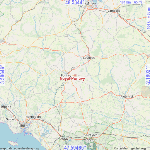
Noyal-Pontivy GPS coordinates[2]
48° 4' 0.012" North, 2° 52' 59.988" West
| Map corner | latitude | longitude |
|---|---|---|
| Upper-left | 48.5344°, | -3.58646° |
| Center: | 48.06667°, | -2.88333° |
| Lower-right: | 47.59465°, | -2.18021° |
| Map W x H: | 104.5×104.5 km | = 64.9×64.9mi |
| max Lat: | 51.07786° ⇑39.5% North |
| Noyal-Pontivy: | 48.06667° |
| min Lat: | ⇓60.5% South 41.3874° |
| min Long | Noyal-Pontivy | max Long |
| -5.08615° | -2.88333° | 9.52242° |
| W 2.9%⇐ | ⇒97.1% E |
Elevation
Elevation of Noyal-Pontivy is 137 m = 449 ft, and this is 56.7 m = 186 ft below average elevation for this country.
| Max E: |
2333 m = 7654 ft | 48.6% |
| Avg. | 193.7 m = 635 ft | |
| Noyal-Pontivy | 137 m = 449 ft | |
Min E: |
-1 m = -3 ft | 51.4% |
See also: France elevation on elevation.city.
Geographical zone
Noyal-Pontivy is located in North temperate zone (between Tropic of Cancer and the Arctic Circle). Distance of this North polar circle is 2056.7 km =1278 mi to North.| Distance of | km | miles | from Noyal-Pontivy |
|---|---|---|---|
| North Pole | 4662.5 | 2897.1 | to North |
| Arctic Circle | 2056.7 | 1278 | to North |
| Tropic Cancer | 2738.6 | 1701.7 | to South |
| Equator | 5344.5 | 3320.9 | to South |


Nearby cities:
15 places around Noyal-Pontivy: (largest is in red/bold)
• Crédin
9.4 km =5.8 mi,  112°
112°
• Gueltas
7.2 km =4.5 mi,  63°
63°
• Hémonstoir
11 km =6.8 mi,  21°
21°
• Kerfourn
4.5 km =2.8 mi,  124°
124°
• Kergrist
10.4 km =6.5 mi,  328°
328°
• Le Sourn
8.2 km =5.1 mi,  251°
251°
• Malguénac
12.7 km =7.9 mi,  276°
276°
• Moustoir-Remungol
7.9 km =4.9 mi,  190°
190°
• Naizin
9.3 km =5.8 mi,  156°
156°
• Neulliac
10.1 km =6.3 mi,  312°
312°
• Pontivy
5.9 km =3.7 mi,  272°
272°
• Rohan
9.8 km =6.1 mi,  88°
88°
• Saint-Gonnery
8 km =5 mi,  36°
36°
• Saint-Gérand
4.7 km =2.9 mi,  352°
352°
• Saint-Thuriau
7.4 km =4.6 mi,  221°
221°
Sources, notices
• [Note1] Compared only with cities in France existing in our database
• [Src1] Map data: © OpenStreetMap contributors (CC-BY-SA)
• [Src2] Other city data from geonames.org with taken over terms of usage.
• [Src3] Geographical zone / Annual Mean Temperature by Robert A. Rohde @ Wikipedia
