Gueltas geodata
Gueltas (Brittany) is a populated place; located in France in Europe/Paris (GMT+2) time zone. With population of 584 people, there are 13570 cities with bigger population in this country. Compared to other cities in France, 61% of cities are located further ↓South; 96.8% of cities are located further →East and 54.8% of cities have higher elevation than Gueltas. Note1
Administrative division(s):
- Level 1: Brittany
- Level 2: Morbihan
- Level 3: Arrondissement de Pontivy
- Level 4: Gueltas


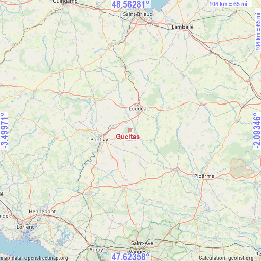
Gueltas GPS coordinates[2]
48° 5' 43.224" North, 2° 47' 47.688" West
| Map corner | latitude | longitude |
|---|---|---|
| Upper-left | 48.56281°, | -3.49971° |
| Center: | 48.09534°, | -2.79658° |
| Lower-right: | 47.62358°, | -2.09346° |
| Map W x H: | 104.4×104.4 km | = 64.9×64.9mi |
| max Lat: | 51.07786° ⇑39% North |
| Gueltas: | 48.09534° |
| min Lat: | ⇓61% South 41.3874° |
| min Long | Gueltas | max Long |
| -5.08615° | -2.79658° | 9.52242° |
| W 3.2%⇐ | ⇒96.8% E |
Elevation
Elevation of Gueltas is 117 m = 384 ft, and this is 76.7 m = 252 ft below average elevation for this country.
| Max E: |
2333 m = 7654 ft | 54.8% |
| Avg. | 193.7 m = 635 ft | |
| Gueltas | 117 m = 384 ft | |
Min E: |
-1 m = -3 ft | 45.2% |
See also: France elevation on elevation.city.
Geographical zone
Gueltas is located in North temperate zone (between Tropic of Cancer and the Arctic Circle). Distance of this North polar circle is 2053.5 km =1276 mi to North.| Distance of | km | miles | from Gueltas |
|---|---|---|---|
| North Pole | 4659.4 | 2895.2 | to North |
| Arctic Circle | 2053.5 | 1276 | to North |
| Tropic Cancer | 2741.8 | 1703.7 | to South |
| Equator | 5347.7 | 3322.9 | to South |


Nearby cities:
15 places around Gueltas: (largest is in red/bold)
• Crédin
7.1 km =4.4 mi,  161°
161°
• Hémonstoir
7.5 km =4.7 mi,  340°
340°
• Kerfourn
6.4 km =4 mi,  205°
205°
• Kergrist
13.2 km =8.2 mi,  295°
295°
• La Chèze
11.1 km =6.9 mi,  69°
69°
• Loudéac
9.7 km =6 mi,  18°
18°
• Naizin
12 km =7.5 mi,  192°
192°
• Noyal-Pontivy
7.2 km =4.5 mi,  243°
243°
• Pontivy
12.7 km =7.9 mi,  256°
256°
• Rohan
4.5 km =2.8 mi,  131°
131°
• Saint-Barnabé
8.2 km =5.1 mi,  55°
55°
• Saint-Caradec
11.5 km =7.1 mi, 342°
• Saint-Gonnery
3.6 km =2.2 mi,  333°
333°
• Saint-Gérand
7.2 km =4.5 mi,  281°
281°
• Trévé
12.9 km =8 mi,  1°
1°
Sources, notices
• [Note1] Compared only with cities in France existing in our database
• [Src1] Map data: © OpenStreetMap contributors (CC-BY-SA)
• [Src2] Other city data from geonames.org with taken over terms of usage.
• [Src3] Geographical zone / Annual Mean Temperature by Robert A. Rohde @ Wikipedia
