Kerfourn geodata
Kerfourn (Brittany) is a populated place; located in France in Europe/Paris (GMT+2) time zone. With population of 779 people, there are 10831 cities with bigger population in this country. Compared to other cities in France, 60.1% of cities are located further ↓South; 96.9% of cities are located further →East and 52% of cities have higher elevation than Kerfourn. Note1
Administrative division(s):
- Level 1: Brittany
- Level 2: Morbihan
- Level 3: Arrondissement de Pontivy
- Level 4: Kerfourn


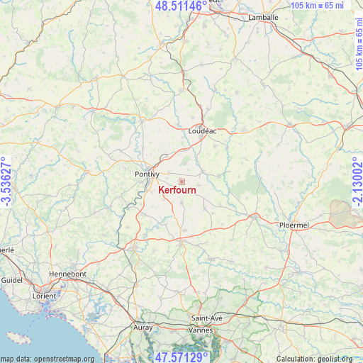
Kerfourn GPS coordinates[2]
48° 2' 36.672" North, 2° 49' 59.304" West
| Map corner | latitude | longitude |
|---|---|---|
| Upper-left | 48.51146°, | -3.53627° |
| Center: | 48.04352°, | -2.83314° |
| Lower-right: | 47.57129°, | -2.13002° |
| Map W x H: | 104.5×104.5 km | = 64.9×64.9mi |
| max Lat: | 51.07786° ⇑39.9% North |
| Kerfourn: | 48.04352° |
| min Lat: | ⇓60.1% South 41.3874° |
| min Long | Kerfourn | max Long |
| -5.08615° | -2.83314° | 9.52242° |
| W 3.1%⇐ | ⇒96.9% E |
Elevation
Elevation of Kerfourn is 125 m = 410 ft, and this is 68.7 m = 225 ft below average elevation for this country.
| Max E: |
2333 m = 7654 ft | 52% |
| Avg. | 193.7 m = 635 ft | |
| Kerfourn | 125 m = 410 ft | |
Min E: |
-1 m = -3 ft | 48% |
See also: France elevation on elevation.city.
Geographical zone
Kerfourn is located in North temperate zone (between Tropic of Cancer and the Arctic Circle). Distance of this North polar circle is 2059.2 km =1279.5 mi to North.| Distance of | km | miles | from Kerfourn |
|---|---|---|---|
| North Pole | 4665.1 | 2898.8 | to North |
| Arctic Circle | 2059.2 | 1279.5 | to North |
| Tropic Cancer | 2736 | 1700.1 | to South |
| Equator | 5341.9 | 3319.3 | to South |


Nearby cities:
15 places around Kerfourn: (largest is in red/bold)
• Crédin
5.1 km =3.2 mi,  101°
101°
• Gueltas
6.4 km =4 mi,  25°
25°
• Hémonstoir
12.8 km =8 mi,  0°
0°
• Le Sourn
11.5 km =7.1 mi,  269°
269°
• Moustoir-Remungol
7.3 km =4.5 mi,  224°
224°
• Naizin
6 km =3.7 mi,  179°
179°
• Noyal-Pontivy
4.5 km =2.8 mi,  304°
304°
• Pleugriffet
12.8 km =8 mi,  120°
120°
• Pontivy
10 km =6.2 mi,  286°
286°
• Radenac
12.7 km =7.9 mi,  134°
134°
• Rohan
6.7 km =4.2 mi,  65°
65°
• Réguiny
9.9 km =6.2 mi,  138°
138°
• Saint-Gonnery
9.1 km =5.7 mi,  6°
6°
• Saint-Gérand
8.4 km =5.2 mi,  328°
328°
• Saint-Thuriau
9.2 km =5.7 mi,  251°
251°
Sources, notices
• [Note1] Compared only with cities in France existing in our database
• [Src1] Map data: © OpenStreetMap contributors (CC-BY-SA)
• [Src2] Other city data from geonames.org with taken over terms of usage.
• [Src3] Geographical zone / Annual Mean Temperature by Robert A. Rohde @ Wikipedia
