Hémonstoir geodata
Hémonstoir (Brittany) is a populated place; located in France in Europe/Paris (GMT+2) time zone. With population of 663 people, there are 12328 cities with bigger population in this country. Compared to other cities in France, 62.1% of cities are located further ↓South; 96.9% of cities are located further →East and 58.7% of cities have higher elevation than Hémonstoir. Note1
Administrative division(s):
- Level 1: Brittany
- Level 2: Département des Côtes-d’Armor
- Level 3: Arrondissement de Saint-Brieuc
- Level 4: Hémonstoir


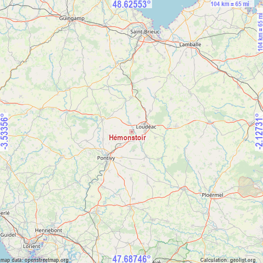
Hémonstoir GPS coordinates[2]
48° 9' 31.104" North, 2° 49' 49.548" West
| Map corner | latitude | longitude |
|---|---|---|
| Upper-left | 48.62553°, | -3.53356° |
| Center: | 48.15864°, | -2.83043° |
| Lower-right: | 47.68746°, | -2.12731° |
| Map W x H: | 104.3×104.3 km | = 64.8×64.8mi |
| max Lat: | 51.07786° ⇑37.9% North |
| Hémonstoir: | 48.15864° |
| min Lat: | ⇓62.1% South 41.3874° |
| min Long | Hémonstoir | max Long |
| -5.08615° | -2.83043° | 9.52242° |
| W 3.1%⇐ | ⇒96.9% E |
Elevation
Elevation of Hémonstoir is 106 m = 348 ft, and this is 87.7 m = 288 ft below average elevation for this country.
| Max E: |
2333 m = 7654 ft | 58.7% |
| Avg. | 193.7 m = 635 ft | |
| Hémonstoir | 106 m = 348 ft | |
Min E: |
-1 m = -3 ft | 41.3% |
See also: France elevation on elevation.city.
Geographical zone
Hémonstoir is located in North temperate zone (between Tropic of Cancer and the Arctic Circle). Distance of this North polar circle is 2046.4 km =1271.6 mi to North.| Distance of | km | miles | from Hémonstoir |
|---|---|---|---|
| North Pole | 4652.3 | 2890.8 | to North |
| Arctic Circle | 2046.4 | 1271.6 | to North |
| Tropic Cancer | 2748.8 | 1708 | to South |
| Equator | 5354.7 | 3327.3 | to South |


Nearby cities:
15 places around Hémonstoir: (largest is in red/bold)
• Gueltas
7.5 km =4.7 mi,  160°
160°
• Kerfourn
12.8 km =8 mi,  180°
180°
• Kergrist
9.5 km =5.9 mi,  261°
261°
• La Motte
11.1 km =6.9 mi,  40°
40°
• Le Quillio
10 km =6.2 mi,  337°
337°
• Loudéac
6.1 km =3.8 mi,  68°
68°
• Mûr-de-Bretagne
12.2 km =7.6 mi,  292°
292°
• Neulliac
11.8 km =7.3 mi,  253°
253°
• Noyal-Pontivy
11 km =6.8 mi,  201°
201°
• Rohan
11.6 km =7.2 mi,  149°
149°
• Saint-Barnabé
9.6 km =6 mi,  104°
104°
• Saint-Caradec
4.1 km =2.5 mi,  345°
345°
• Saint-Gonnery
3.9 km =2.4 mi,  166°
166°
• Saint-Gérand
7.2 km =4.5 mi,  218°
218°
• Trévé
6.5 km =4 mi,  25°
25°
Sources, notices
• [Note1] Compared only with cities in France existing in our database
• [Src1] Map data: © OpenStreetMap contributors (CC-BY-SA)
• [Src2] Other city data from geonames.org with taken over terms of usage.
• [Src3] Geographical zone / Annual Mean Temperature by Robert A. Rohde @ Wikipedia
