Noirmoutier-en-l’Île geodata
Noirmoutier-en-l’Île (Pays de la Loire) is a populated place; located in France in Europe/Paris (GMT+2) time zone. With population of 4,800 people, there are 2066 cities with bigger population in this country. Compared to other cities in France, 55.3% of cities are located further ↑North; 95.7% of cities are located further →East and 98.2% of cities have higher elevation than Noirmoutier-en-l’Île. Note1
Administrative division(s):
- Level 1: Pays de la Loire
- Level 2: Département de la Vendée
- Level 3: Arrondissement des Sables-d'Olonne
- Level 4: Noirmoutier-en-l'Île


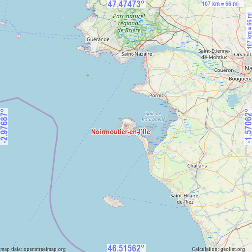
Noirmoutier-en-l’Île GPS coordinates[2]
46° 59' 50.388" North, 2° 16' 25.464" West
| Map corner | latitude | longitude |
|---|---|---|
| Upper-left | 47.47473°, | -2.97687° |
| Center: | 46.99733°, | -2.27374° |
| Lower-right: | 46.51562°, | -1.57062° |
| Map W x H: | 106.6×106.6 km | = 66.2×66.2mi |
| max Lat: | 51.07786° ⇑55.3% North |
| Noirmoutier-en-l’Île: | 46.99733° |
| min Lat: | ⇓44.7% South 41.3874° |
| min Long | Noirmoutier-en- | max Long |
| -5.08615° | -2.27374° | 9.52242° |
| W 4.3%⇐ | ⇒95.7% E |
Elevation
Elevation of Noirmoutier-en-l’Île is 8 m = 26 ft, and this is 185.7 m = 609 ft below average elevation for this country.
| Max E: |
2333 m = 7654 ft | 98.2% |
| Avg. | 193.7 m = 635 ft | |
| Noirmoutier-en-l’Île | 8 m = 26 ft | |
Min E: |
-1 m = -3 ft | 1.8% |
See also: France elevation on elevation.city.
Geographical zone
Noirmoutier-en-l’Île is located in North temperate zone (between Tropic of Cancer and the Arctic Circle). Distance of this North polar circle is 2175.6 km =1351.9 mi to North.| Distance of | km | miles | from Noirmoutier-en-l’Île |
|---|---|---|---|
| North Pole | 4781.4 | 2971 | to North |
| Arctic Circle | 2175.6 | 1351.9 | to North |
| Tropic Cancer | 2619.7 | 1627.8 | to South |
| Equator | 5225.6 | 3247 | to South |


Nearby cities:
15 places around Noirmoutier-en-l’Île: (largest is in red/bold)
• Barbâtre
9.6 km =6 mi,  130°
130°
• Beauvoir-sur-Mer
20 km =12.4 mi,  118°
118°
• Bouin
21.1 km =13.1 mi,  97°
97°
• Bourgneuf-en-Retz
25 km =15.5 mi,  78°
78°
• La Barre-de-Monts
17.4 km =10.8 mi,  138°
138°
• La Bernerie-en-Retz
20.2 km =12.6 mi,  62°
62°
• La Guérinière
4.6 km =2.9 mi, 138°
• La Plaine-sur-Mer
16.6 km =10.3 mi,  21°
21°
• Les Moutiers-en-Retz
22.1 km =13.7 mi,  70°
70°
• Notre-Dame-de-Monts
21.4 km =13.3 mi,  149°
149°
• Pornic
18.9 km =11.7 mi,  47°
47°
• Préfailles
15.2 km =9.4 mi, 16°
• Saint-Gervais
23.2 km =14.4 mi, 117°
• Saint-Michel-Chef-Chef
22.5 km =14 mi, 24°
• Saint-Urbain
24.2 km =15 mi, 124°
Sources, notices
• [Note1] Compared only with cities in France existing in our database
• [Src1] Map data: © OpenStreetMap contributors (CC-BY-SA)
• [Src2] Other city data from geonames.org with taken over terms of usage.
• [Src3] Geographical zone / Annual Mean Temperature by Robert A. Rohde @ Wikipedia
