La Barre-de-Monts geodata
La Barre-de-Monts (Pays de la Loire) is a populated place; located in France in Europe/Paris (GMT+2) time zone. With population of 1,922 people, there are 4987 cities with bigger population in this country. Compared to other cities in France, 56.4% of cities are located further ↑North; 95.3% of cities are located further →East and 99.8% of cities have higher elevation than La Barre-de-Monts. Note1
Administrative division(s):
- Level 1: Pays de la Loire
- Level 2: Département de la Vendée
- Level 3: Arrondissement des Sables-d'Olonne
- Level 4: La Barre-de-Monts


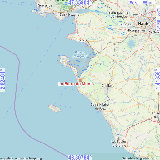
La Barre-de-Monts GPS coordinates[2]
46° 52' 50.124" North, 2° 7' 18.048" West
| Map corner | latitude | longitude |
|---|---|---|
| Upper-left | 47.35904°, | -2.82481° |
| Center: | 46.88059°, | -2.12168° |
| Lower-right: | 46.39784°, | -1.41856° |
| Map W x H: | 106.9×106.9 km | = 66.4×66.4mi |
| max Lat: | 51.07786° ⇑56.4% North |
| La Barre-de-Monts: | 46.88059° |
| min Lat: | ⇓43.6% South 41.3874° |
| min Long | La Barre-de-Mon | max Long |
| -5.08615° | -2.12168° | 9.52242° |
| W 4.7%⇐ | ⇒95.3% E |
Elevation
Elevation of La Barre-de-Monts is 3 m = 10 ft, and this is 190.7 m = 626 ft below average elevation for this country.
| Max E: |
2333 m = 7654 ft | 99.8% |
| Avg. | 193.7 m = 635 ft | |
| La Barre-de-Monts | 3 m = 10 ft | |
Min E: |
-1 m = -3 ft | 0.2% |
See also: France elevation on elevation.city.
Geographical zone
La Barre-de-Monts is located in North temperate zone (between Tropic of Cancer and the Arctic Circle). Distance of this North polar circle is 2188.5 km =1359.9 mi to North.| Distance of | km | miles | from La Barre-de-Monts |
|---|---|---|---|
| North Pole | 4794.4 | 2979.1 | to North |
| Arctic Circle | 2188.5 | 1359.9 | to North |
| Tropic Cancer | 2606.7 | 1619.7 | to South |
| Equator | 5212.6 | 3239 | to South |


Nearby cities:
15 places around La Barre-de-Monts: (largest is in red/bold)
• Barbâtre
8 km =5 mi,  327°
327°
• Beauvoir-sur-Mer
7.1 km =4.4 mi,  59°
59°
• Bois-de-Cené
18.9 km =11.7 mi,  70°
70°
• Bouin
13.9 km =8.6 mi,  42°
42°
• Challans
19.2 km =11.9 mi,  102°
102°
• Châteauneuf
16.1 km =10 mi, 74°
• La Guérinière
12.8 km =8 mi,  318°
318°
• Le Perrier
11.9 km =7.4 mi,  124°
124°
• Noirmoutier-en-l’Île
17.4 km =10.8 mi, 318°
• Notre-Dame-de-Monts
5.6 km =3.5 mi,  187°
187°
• Saint-Gervais
9.4 km =5.8 mi,  75°
75°
• Saint-Jean-de-Monts
10.4 km =6.5 mi,  163°
163°
• Saint-Urbain
8.5 km =5.3 mi,  93°
93°
• Sallertaine
12.9 km =8 mi, 100°
• Soullans
19.2 km =11.9 mi, 119°
Sources, notices
• [Note1] Compared only with cities in France existing in our database
• [Src1] Map data: © OpenStreetMap contributors (CC-BY-SA)
• [Src2] Other city data from geonames.org with taken over terms of usage.
• [Src3] Geographical zone / Annual Mean Temperature by Robert A. Rohde @ Wikipedia
