Saint-Germain-de-la-Coudre geodata
Saint-Germain-de-la-Coudre (Normandy) is a populated place; located in France in Europe/Paris (GMT+2) time zone. With population of 814 people, there are 10439 cities with bigger population in this country. Compared to other cities in France, 64.2% of cities are located further ↓South; 72.3% of cities are located further →East and 58.7% of cities have higher elevation than Saint-Germain-de-la-Coudre. Note1
Administrative division(s):
- Level 1: Normandy
- Level 2: Département de l'Orne
- Level 3: Arrondissement de Mortagne-au-Perche
- Level 4: Saint-Germain-de-la-Coudre
Current local time in Saint-Germain-de-la-Coudre:
11:32 AM, SaturdayDifference from your time zone: hours


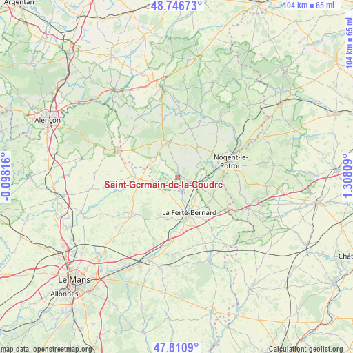
Saint-Germain-de-la-Coudre GPS coordinates[2]
48° 16' 51.456" North, 0° 36' 17.856" East
| Map corner | latitude | longitude |
|---|---|---|
| Upper-left | 48.74673°, | -0.09816° |
| Center: | 48.28096°, | 0.60496° |
| Lower-right: | 47.8109°, | 1.30809° |
| Map W x H: | 104.1×104.1 km | = 64.7×64.7mi |
| max Lat: | 51.07786° ⇑35.8% North |
| Saint-Germain-de-la-Coudre: | 48.28096° |
| min Lat: | ⇓64.2% South 41.3874° |
| min Long | Saint-Germain-d | max Long |
| -5.08615° | 0.60496° | 9.52242° |
| W 27.7%⇐ | ⇒72.3% E |
Elevation
Elevation of Saint-Germain-de-la-Coudre is 106 m = 348 ft, and this is 87.7 m = 288 ft below average elevation for this country.
| Max E: |
2333 m = 7654 ft | 58.7% |
| Avg. | 193.7 m = 635 ft | |
| Saint-Germain-de-la-Coudre | 106 m = 348 ft | |
Min E: |
-1 m = -3 ft | 41.3% |
See also: France elevation on elevation.city.
Geographical zone
Saint-Germain-de-la-Coudre is located in North temperate zone (between Tropic of Cancer and the Arctic Circle). Distance of this North polar circle is 2032.8 km =1263.1 mi to North.| Distance of | km | miles | from Saint-Germain-de-la-Coudre |
|---|---|---|---|
| North Pole | 4638.7 | 2882.4 | to North |
| Arctic Circle | 2032.8 | 1263.1 | to North |
| Tropic Cancer | 2762.4 | 1716.5 | to South |
| Equator | 5368.3 | 3335.7 | to South |


Nearby cities:
15 places around Saint-Germain-de-la-Coudre: (largest is in red/bold)
• Avezé
8.1 km =5 mi,  138°
138°
• Bellême
10.6 km =6.6 mi,  345°
345°
• Cherreau
11.4 km =7.1 mi,  149°
149°
• Igé
7.8 km =4.8 mi,  308°
308°
• La Chapelle-du-Bois
6.6 km =4.1 mi,  187°
187°
• La Ferté-Bernard
11.1 km =6.9 mi,  161°
161°
• La Rouge
7.7 km =4.8 mi,  84°
84°
• Le Gué-de-la-Chaîne
12.1 km =7.5 mi,  328°
328°
• Mâle
9.9 km =6.2 mi,  96°
96°
• Nogent-le-Bernard
9.9 km =6.2 mi,  239°
239°
• Préaux-du-Perche
10.1 km =6.3 mi,  54°
54°
• Préval
5.3 km =3.3 mi, 164°
• Saint-Cosme-en-Vairais
10.4 km =6.5 mi,  261°
261°
• Saint-Hilaire-sur-Erre
10.5 km =6.5 mi,  70°
70°
• Saint-Martin-du-Vieux-Bellême
12 km =7.5 mi,  337°
337°
Sources, notices
• [Note1] Compared only with cities in France existing in our database
• [Src1] Map data: © OpenStreetMap contributors (CC-BY-SA)
• [Src2] Other city data from geonames.org with taken over terms of usage.
• [Src3] Geographical zone / Annual Mean Temperature by Robert A. Rohde @ Wikipedia
