La Ferté-Bernard geodata
La Ferté-Bernard (Pays de la Loire) is a populated place; located in France in Europe/Paris (GMT+2) time zone. With population of 10,201 people, there are 930 cities with bigger population in this country. Compared to other cities in France, 62.6% of cities are located further ↓South; 71.8% of cities are located further →East and 66.6% of cities have higher elevation than La Ferté-Bernard. Note1
Administrative division(s):
- Level 1: Pays de la Loire
- Level 2: Sarthe
- Level 3: Arrondissement de Mamers
- Level 4: La Ferté-Bernard


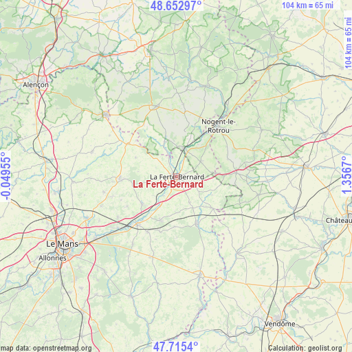
La Ferté-Bernard GPS coordinates[2]
48° 11' 10.788" North, 0° 39' 12.852" East
| Map corner | latitude | longitude |
|---|---|---|
| Upper-left | 48.65297°, | -0.04955° |
| Center: | 48.18633°, | 0.65357° |
| Lower-right: | 47.7154°, | 1.3567° |
| Map W x H: | 104.2×104.2 km | = 64.7×64.7mi |
| max Lat: | 51.07786° ⇑37.4% North |
| La Ferté-Bernard: | 48.18633° |
| min Lat: | ⇓62.6% South 41.3874° |
| min Long | La Ferté-Berna | max Long |
| -5.08615° | 0.65357° | 9.52242° |
| W 28.2%⇐ | ⇒71.8% E |
Elevation
Elevation of La Ferté-Bernard is 86 m = 282 ft, and this is 107.7 m = 353 ft below average elevation for this country.
| Max E: |
2333 m = 7654 ft | 66.6% |
| Avg. | 193.7 m = 635 ft | |
| La Ferté-Bernard | 86 m = 282 ft | |
Min E: |
-1 m = -3 ft | 33.4% |
See also: France elevation on elevation.city.
Geographical zone
La Ferté-Bernard is located in North temperate zone (between Tropic of Cancer and the Arctic Circle). Distance of this North polar circle is 2043.4 km =1269.7 mi to North.| Distance of | km | miles | from La Ferté-Bernard |
|---|---|---|---|
| North Pole | 4649.2 | 2888.9 | to North |
| Arctic Circle | 2043.4 | 1269.7 | to North |
| Tropic Cancer | 2751.9 | 1710 | to South |
| Equator | 5357.8 | 3329.2 | to South |


Nearby cities:
15 places around La Ferté-Bernard: (largest is in red/bold)
• Avezé
4.9 km =3 mi,  22°
22°
• Boëssé-le-Sec
8.8 km =5.5 mi,  229°
229°
• Ceton
8.4 km =5.2 mi,  58°
58°
• Cherreau
2.4 km =1.5 mi,  71°
71°
• Cherré
1.5 km =0.9 mi,  168°
168°
• Cormes
4.3 km =2.7 mi,  116°
116°
• La Chapelle-du-Bois
6 km =3.7 mi,  311°
311°
• La Rouge
12 km =7.5 mi, 20°
• Lamnay
8.6 km =5.3 mi,  152°
152°
• Mâle
11.3 km =7 mi,  33°
33°
• Préval
5.9 km =3.7 mi,  338°
338°
• Saint-Aubin-des-Coudrais
5.3 km =3.3 mi,  251°
251°
• Saint-Germain-de-la-Coudre
11.1 km =6.9 mi, 341°
• Saint-Maixent
10.8 km =6.7 mi,  180°
180°
• Sceaux-sur-Huisne
10.4 km =6.5 mi,  209°
209°
Sources, notices
• [Note1] Compared only with cities in France existing in our database
• [Src1] Map data: © OpenStreetMap contributors (CC-BY-SA)
• [Src2] Other city data from geonames.org with taken over terms of usage.
• [Src3] Geographical zone / Annual Mean Temperature by Robert A. Rohde @ Wikipedia
