Igé geodata
Igé (Normandy) is a populated place; located in France in Europe/Paris (GMT+2) time zone. With population of 713 people, there are 11611 cities with bigger population in this country. Compared to other cities in France, 65% of cities are located further ↓South; 73.2% of cities are located further →East and 50.2% of cities have higher elevation than Igé. Note1
Administrative division(s):
- Level 1: Normandy
- Level 2: Département de l'Orne
- Level 3: Arrondissement de Mortagne-au-Perche
- Level 4: Igé


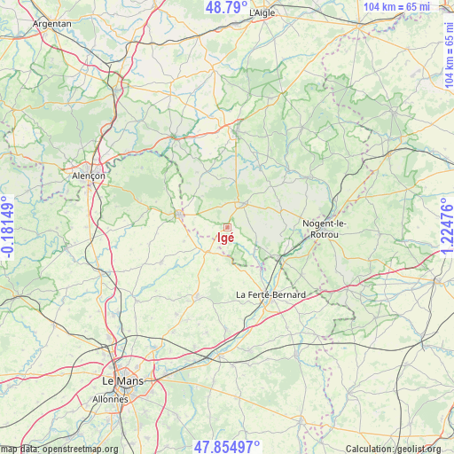
Igé GPS coordinates[2]
48° 19' 28.668" North, 0° 31' 17.904" East
| Map corner | latitude | longitude |
|---|---|---|
| Upper-left | 48.79°, | -0.18149° |
| Center: | 48.32463°, | 0.52164° |
| Lower-right: | 47.85497°, | 1.22476° |
| Map W x H: | 104×104 km | = 64.6×64.6mi |
| max Lat: | 51.07786° ⇑35% North |
| Igé: | 48.32463° |
| min Lat: | ⇓65% South 41.3874° |
| min Long | Igé | max Long |
| -5.08615° | 0.52164° | 9.52242° |
| W 26.8%⇐ | ⇒73.2% E |
Elevation
Elevation of Igé is 131 m = 430 ft, and this is 62.7 m = 206 ft below average elevation for this country.
| Max E: |
2333 m = 7654 ft | 50.2% |
| Avg. | 193.7 m = 635 ft | |
| Igé | 131 m = 430 ft | |
Min E: |
-1 m = -3 ft | 49.8% |
See also: France elevation on elevation.city.
Geographical zone
Igé is located in North temperate zone (between Tropic of Cancer and the Arctic Circle). Distance of this North polar circle is 2028 km =1260.1 mi to North.| Distance of | km | miles | from Igé |
|---|---|---|---|
| North Pole | 4633.9 | 2879.4 | to North |
| Arctic Circle | 2028 | 1260.1 | to North |
| Tropic Cancer | 2767.3 | 1719.5 | to South |
| Equator | 5373.2 | 3338.8 | to South |


Nearby cities:
15 places around Igé: (largest is in red/bold)
• Bellême
6.5 km =4 mi,  33°
33°
• La Chapelle-du-Bois
12.6 km =7.8 mi,  155°
155°
• La Rouge
14.5 km =9 mi,  106°
106°
• Le Gué-de-la-Chaîne
5.5 km =3.4 mi,  358°
358°
• Le Pin-la-Garenne
13.3 km =8.3 mi,  8°
8°
• Mamers
11.6 km =7.2 mi,  283°
283°
• Mauves-sur-Huisne
15.8 km =9.8 mi, 27°
• Nocé
13.3 km =8.3 mi,  62°
62°
• Nogent-le-Bernard
10.1 km =6.3 mi,  193°
193°
• Préaux-du-Perche
14.4 km =8.9 mi,  86°
86°
• Préval
12.5 km =7.8 mi,  142°
142°
• Saint-Cosme-en-Vairais
7.6 km =4.7 mi,  212°
212°
• Saint-Germain-de-la-Coudre
7.8 km =4.8 mi,  128°
128°
• Saint-Martin-du-Vieux-Bellême
6.4 km =4 mi, 14°
• Saint-Rémy-des-Monts
9.2 km =5.7 mi,  259°
259°
Sources, notices
• [Note1] Compared only with cities in France existing in our database
• [Src1] Map data: © OpenStreetMap contributors (CC-BY-SA)
• [Src2] Other city data from geonames.org with taken over terms of usage.
• [Src3] Geographical zone / Annual Mean Temperature by Robert A. Rohde @ Wikipedia
