Nogent-le-Bas geodata
Nogent-le-Bas (Grand Est) is a populated place; located in France in Europe/Paris (GMT+2) time zone. With population of 4,076 people, there are 2413 cities with bigger population in this country. Compared to other cities in France, 59.6% of cities are located further ↓South; 80.9% of cities are located further ←West and 83.4% of cities have lower elevation than Nogent-le-Bas. Note1
Administrative division(s):
- Level 1: Grand Est
- Level 2: Haute-Marne
- Level 3: Arrondissement de Chaumont
- Level 4: Nogent


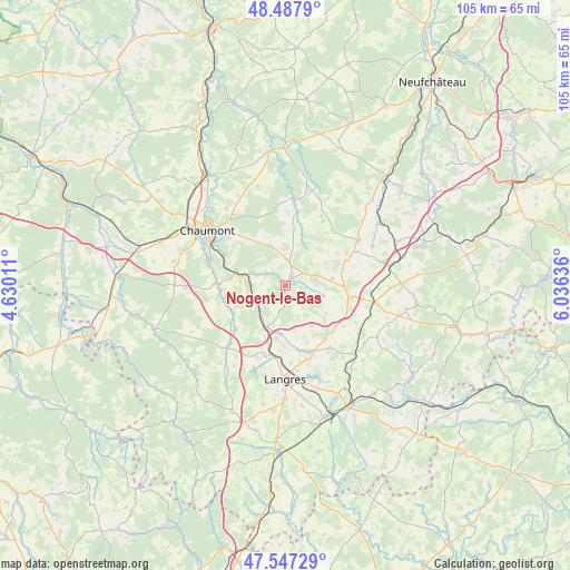
Nogent-le-Bas GPS coordinates[2]
48° 1' 11.064" North, 5° 19' 59.628" East
| Map corner | latitude | longitude |
|---|---|---|
| Upper-left | 48.4879°, | 4.63011° |
| Center: | 48.01974°, | 5.33323° |
| Lower-right: | 47.54729°, | 6.03636° |
| Map W x H: | 104.6×104.6 km | = 65×65mi |
| max Lat: | 51.07786° ⇑40.4% North |
| Nogent-le-Bas: | 48.01974° |
| min Lat: | ⇓59.6% South 41.3874° |
| min Long | Nogent-le-Bas | max Long |
| -5.08615° | 5.33323° | 9.52242° |
| W 80.9%⇐ | ⇒19.1% E |
Elevation
Elevation of Nogent-le-Bas is 327 m = 1073 ft, and this is 133.3 m = 437 ft above average elevation for this country.
| Max E: |
2333 m = 7654 ft | 16.6% |
| Nogent-le-Bas | 327 m 1073 ft | |
| Avg. | 193.7 m = 635 ft | |
Min E: |
-1 m = -3 ft | 83.4% |
See also: France elevation on elevation.city.
Geographical zone
Nogent-le-Bas is located in North temperate zone (between Tropic of Cancer and the Arctic Circle). Distance of this North polar circle is 2061.9 km =1281.2 mi to North.| Distance of | km | miles | from Nogent-le-Bas |
|---|---|---|---|
| North Pole | 4667.8 | 2900.4 | to North |
| Arctic Circle | 2061.9 | 1281.2 | to North |
| Tropic Cancer | 2733.4 | 1698.5 | to South |
| Equator | 5339.3 | 3317.7 | to South |


Nearby cities:
15 places around Nogent-le-Bas: (largest is in red/bold)
• Avrecourt
16.4 km =10.2 mi,  112°
112°
• Biesles
7.9 km =4.9 mi,  338°
338°
• Breuvannes-en-Bassigny
22.9 km =14.2 mi,  67°
67°
• Chamarandes-Choignes
15.3 km =9.5 mi,  297°
297°
• Chaumont
17.5 km =10.9 mi,  305°
305°
• Foulain
9.2 km =5.7 mi,  283°
283°
• Humes-Jorquenay
13.8 km =8.6 mi,  195°
195°
• Is-en-Bassigny
8.6 km =5.3 mi,  81°
81°
• Jonchery
22.5 km =14 mi, 305°
• Langres
17.5 km =10.9 mi,  180°
180°
• Rolampont
8.6 km =5.3 mi, 204°
• Saints-Geosmes
20.7 km =12.9 mi, 179°
• Saulxures
20 km =12.4 mi, 110°
• Val-de-Meuse
12.6 km =7.8 mi,  100°
100°
• Villiers-le-Sec
22.2 km =13.8 mi,  294°
294°
Sources, notices
• [Note1] Compared only with cities in France existing in our database
• [Src1] Map data: © OpenStreetMap contributors (CC-BY-SA)
• [Src2] Other city data from geonames.org with taken over terms of usage.
• [Src3] Geographical zone / Annual Mean Temperature by Robert A. Rohde @ Wikipedia
