Avrecourt geodata
Avrecourt (Grand Est) is a seat of a fourth-order administrative division; located in France in Europe/Paris (GMT+2) time zone. In our database, there are 15246 cities with bigger population. Compared to other cities in France, 58.6% of cities are located further ↓South; 83.2% of cities are located further ←West and 86.2% of cities have lower elevation than Avrecourt. Note1
Administrative division(s):
- Level 1: Grand Est
- Level 2: Haute-Marne
- Level 3: Arrondissement de Langres
- Level 4: Avrecourt


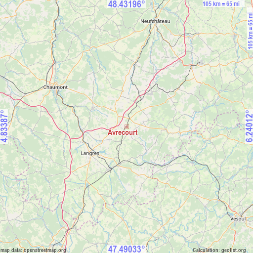
Avrecourt GPS coordinates[2]
47° 57' 47.844" North, 5° 32' 13.164" East
| Map corner | latitude | longitude |
|---|---|---|
| Upper-left | 48.43196°, | 4.83387° |
| Center: | 47.96329°, | 5.53699° |
| Lower-right: | 47.49033°, | 6.24012° |
| Map W x H: | 104.7×104.7 km | = 65.1×65.1mi |
| max Lat: | 51.07786° ⇑41.4% North |
| Avrecourt: | 47.96329° |
| min Lat: | ⇓58.6% South 41.3874° |
| min Long | Avrecourt | max Long |
| -5.08615° | 5.53699° | 9.52242° |
| W 83.2%⇐ | ⇒16.8% E |
Elevation
Elevation of Avrecourt is 363 m = 1191 ft, and this is 169.3 m = 555 ft above average elevation for this country.
| Max E: |
2333 m = 7654 ft | 13.8% |
| Avrecourt | 363 m 1191 ft | |
| Avg. | 193.7 m = 635 ft | |
Min E: |
-1 m = -3 ft | 86.2% |
See also: France elevation on elevation.city.
Geographical zone
Avrecourt is located in North temperate zone (between Tropic of Cancer and the Arctic Circle). Distance of this North polar circle is 2068.2 km =1285.1 mi to North.| Distance of | km | miles | from Avrecourt |
|---|---|---|---|
| North Pole | 4674 | 2904.3 | to North |
| Arctic Circle | 2068.2 | 1285.1 | to North |
| Tropic Cancer | 2727.1 | 1694.5 | to South |
| Equator | 5333 | 3313.8 | to South |


Nearby cities:
15 places around Avrecourt: (largest is in red/bold)
• Bourbonne-les-Bains
15.8 km =9.8 mi,  94°
94°
• Breuvannes-en-Bassigny
16.3 km =10.1 mi,  21°
21°
• Chalindrey
19.6 km =12.2 mi,  204°
204°
• Chézeaux
12.7 km =7.9 mi,  139°
139°
• Culmont
17.1 km =10.6 mi, 204°
• Fayl-Billot
20.7 km =12.9 mi,  167°
167°
• Haute-Amance
14.5 km =9 mi,  176°
176°
• Humes-Jorquenay
20.2 km =12.6 mi,  249°
249°
• Is-en-Bassigny
10.1 km =6.3 mi,  318°
318°
• Langres
18.9 km =11.7 mi,  233°
233°
• Nogent-le-Bas
16.4 km =10.2 mi,  292°
292°
• Rolampont
18.8 km =11.7 mi,  265°
265°
• Saulxures
3.7 km =2.3 mi,  103°
103°
• Torcenay
17.3 km =10.7 mi, 197°
• Val-de-Meuse
4.9 km =3 mi,  326°
326°
Sources, notices
• [Note1] Compared only with cities in France existing in our database
• [Src1] Map data: © OpenStreetMap contributors (CC-BY-SA)
• [Src2] Other city data from geonames.org with taken over terms of usage.
• [Src3] Geographical zone / Annual Mean Temperature by Robert A. Rohde @ Wikipedia
