Saints-Geosmes geodata
Saints-Geosmes (Grand Est) is a populated place; located in France in Europe/Paris (GMT+2) time zone. With population of 932 people, there are 9370 cities with bigger population in this country. Compared to other cities in France, 56.3% of cities are located further ↓South; 80.9% of cities are located further ←West and 91.1% of cities have lower elevation than Saints-Geosmes. Note1
Administrative division(s):
- Level 1: Grand Est
- Level 2: Haute-Marne
- Level 3: Arrondissement de Langres
- Level 4: Saints-Geosmes


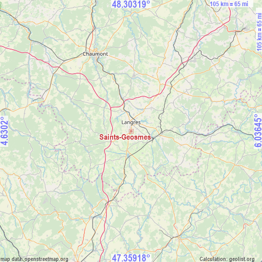
Saints-Geosmes GPS coordinates[2]
47° 49' 59.988" North, 5° 19' 59.988" East
| Map corner | latitude | longitude |
|---|---|---|
| Upper-left | 48.30319°, | 4.6302° |
| Center: | 47.83333°, | 5.33333° |
| Lower-right: | 47.35918°, | 6.03645° |
| Map W x H: | 105×105 km | = 65.2×65.2mi |
| max Lat: | 51.07786° ⇑43.7% North |
| Saints-Geosmes: | 47.83333° |
| min Lat: | ⇓56.3% South 41.3874° |
| min Long | Saints-Geosmes | max Long |
| -5.08615° | 5.33333° | 9.52242° |
| W 80.9%⇐ | ⇒19.1% E |
Elevation
Elevation of Saints-Geosmes is 451 m = 1480 ft, and this is 257.3 m = 844 ft above average elevation for this country.
| Max E: |
2333 m = 7654 ft | 8.9% |
| Saints-Geosmes | 451 m 1480 ft | |
| Avg. | 193.7 m = 635 ft | |
Min E: |
-1 m = -3 ft | 91.1% |
See also: France elevation on elevation.city.
Geographical zone
Saints-Geosmes is located in North temperate zone (between Tropic of Cancer and the Arctic Circle). Distance of this North polar circle is 2082.6 km =1294.1 mi to North.| Distance of | km | miles | from Saints-Geosmes |
|---|---|---|---|
| North Pole | 4688.5 | 2913.3 | to North |
| Arctic Circle | 2082.6 | 1294.1 | to North |
| Tropic Cancer | 2712.6 | 1685.5 | to South |
| Equator | 5318.6 | 3304.8 | to South |


Nearby cities:
15 places around Saints-Geosmes: (largest is in red/bold)
• Avrecourt
21 km =13 mi,  46°
46°
• Chalindrey
7.8 km =4.8 mi,  115°
115°
• Culmont
8.2 km =5.1 mi,  98°
98°
• Fayl-Billot
20.7 km =12.9 mi,  106°
106°
• Haute-Amance
16.2 km =10.1 mi,  90°
90°
• Humes-Jorquenay
8.3 km =5.2 mi,  333°
333°
• Langres
3.3 km =2.1 mi,  359°
359°
• Longeau-Percey
7.8 km =4.8 mi,  198°
198°
• Nogent-le-Bas
20.7 km =12.9 mi, 359°
• Prauthoy
17.3 km =10.7 mi,  189°
189°
• Rolampont
13.4 km =8.3 mi,  344°
344°
• Torcenay
10.2 km =6.3 mi, 101°
• Val-de-Meuse
22.3 km =13.9 mi,  33°
33°
• Vaux-sous-Aubigny
20.1 km =12.5 mi, 189°
• Villegusien-le-Lac
10.8 km =6.7 mi,  184°
184°
Sources, notices
• [Note1] Compared only with cities in France existing in our database
• [Src1] Map data: © OpenStreetMap contributors (CC-BY-SA)
• [Src2] Other city data from geonames.org with taken over terms of usage.
• [Src3] Geographical zone / Annual Mean Temperature by Robert A. Rohde @ Wikipedia
