Niort geodata
Niort (Nouvelle-Aquitaine) is a seat of a second-order administrative division; located in France in Europe/Paris (GMT+2) time zone. With population of 54,660 people, there are 97 cities with bigger population in this country. Compared to other cities in France, 62% of cities are located further ↑North; 82.9% of cities are located further →East and 93.6% of cities have higher elevation than Niort. Note1
Administrative division(s):
- Level 1: Nouvelle-Aquitaine
- Level 2: Département des Deux-Sèvres
- Level 3: Arrondissement de Niort
- Level 4: Niort


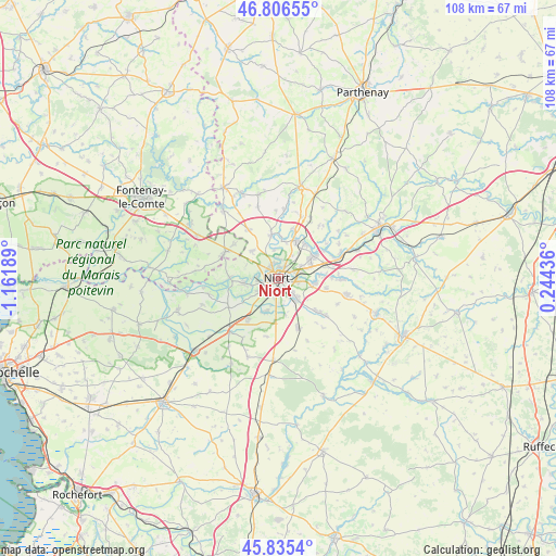
Niort GPS coordinates[2]
46° 19' 23.268" North, 0° 27' 31.572" West
| Map corner | latitude | longitude |
|---|---|---|
| Upper-left | 46.80655°, | -1.16189° |
| Center: | 46.32313°, | -0.45877° |
| Lower-right: | 45.8354°, | 0.24436° |
| Map W x H: | 108×108 km | = 67.1×67.1mi |
| max Lat: | 51.07786° ⇑62% North |
| Niort: | 46.32313° |
| min Lat: | ⇓38% South 41.3874° |
| min Long | Niort | max Long |
| -5.08615° | -0.45877° | 9.52242° |
| W 17.1%⇐ | ⇒82.9% E |
Elevation
Elevation of Niort is 21 m = 69 ft, and this is 172.7 m = 567 ft below average elevation for this country.
| Max E: |
2333 m = 7654 ft | 93.6% |
| Avg. | 193.7 m = 635 ft | |
| Niort | 21 m = 69 ft | |
Min E: |
-1 m = -3 ft | 6.4% |
See also: Niort elevation on elevation.city.
Geographical zone
Niort is located in North temperate zone (between Tropic of Cancer and the Arctic Circle). Distance of this North polar circle is 2250.5 km =1398.4 mi to North.| Distance of | km | miles | from Niort |
|---|---|---|---|
| North Pole | 4856.4 | 3017.6 | to North |
| Arctic Circle | 2250.5 | 1398.4 | to North |
| Tropic Cancer | 2544.7 | 1581.2 | to South |
| Equator | 5150.6 | 3200.4 | to South |


Nearby cities:
15 places around Niort: (largest is in red/bold)
• Aiffres
5.1 km =3.2 mi,  138°
138°
• Bessines
5 km =3.1 mi,  242°
242°
• Chauray
7.5 km =4.7 mi,  56°
56°
• Coulon
9.7 km =6 mi,  270°
270°
• Fors
10.4 km =6.5 mi,  158°
158°
• François
10.2 km =6.3 mi, 58°
• Frontenay-Rohan-Rohan
9.9 km =6.2 mi,  217°
217°
• Magné
6.8 km =4.2 mi,  262°
262°
• Saint-Gelais
8.5 km =5.3 mi,  38°
38°
• Saint-Maxire
8.6 km =5.3 mi,  349°
349°
• Saint-Rémy
7.5 km =4.7 mi,  315°
315°
• Saint-Symphorien
7 km =4.3 mi,  201°
201°
• Sciecq
5.6 km =3.5 mi, 350°
• Vouillé
7.1 km =4.4 mi,  97°
97°
• Échiré
8.1 km =5 mi,  23°
23°
Sources, notices
• [Note1] Compared only with cities in France existing in our database
• [Src1] Map data: © OpenStreetMap contributors (CC-BY-SA)
• [Src2] Other city data from geonames.org with taken over terms of usage.
• [Src3] Geographical zone / Annual Mean Temperature by Robert A. Rohde @ Wikipedia
