Aiffres geodata
Aiffres (Nouvelle-Aquitaine) is a populated place; located in France in Europe/Paris (GMT+2) time zone. With population of 4,815 people, there are 2058 cities with bigger population in this country. Compared to other cities in France, 62.5% of cities are located further ↑North; 82.3% of cities are located further →East and 89.5% of cities have higher elevation than Aiffres. Note1
Administrative division(s):
- Level 1: Nouvelle-Aquitaine
- Level 2: Département des Deux-Sèvres
- Level 3: Arrondissement de Niort
- Level 4: Aiffres


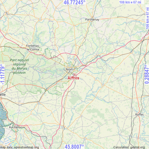
Aiffres GPS coordinates[2]
46° 17' 19.428" North, 0° 24' 52.776" West
| Map corner | latitude | longitude |
|---|---|---|
| Upper-left | 46.77245°, | -1.11779° |
| Center: | 46.28873°, | -0.41466° |
| Lower-right: | 45.8007°, | 0.28847° |
| Map W x H: | 108×108 km | = 67.1×67.1mi |
| max Lat: | 51.07786° ⇑62.5% North |
| Aiffres: | 46.28873° |
| min Lat: | ⇓37.5% South 41.3874° |
| min Long | Aiffres | max Long |
| -5.08615° | -0.41466° | 9.52242° |
| W 17.7%⇐ | ⇒82.3% E |
Elevation
Elevation of Aiffres is 31 m = 102 ft, and this is 162.7 m = 534 ft below average elevation for this country.
| Max E: |
2333 m = 7654 ft | 89.5% |
| Avg. | 193.7 m = 635 ft | |
| Aiffres | 31 m = 102 ft | |
Min E: |
-1 m = -3 ft | 10.5% |
See also: France elevation on elevation.city.
Geographical zone
Aiffres is located in North temperate zone (between Tropic of Cancer and the Arctic Circle). Distance of this North polar circle is 2254.3 km =1400.8 mi to North.| Distance of | km | miles | from Aiffres |
|---|---|---|---|
| North Pole | 4860.2 | 3020 | to North |
| Arctic Circle | 2254.3 | 1400.8 | to North |
| Tropic Cancer | 2540.9 | 1578.8 | to South |
| Equator | 5146.8 | 3198.1 | to South |


Nearby cities:
15 places around Aiffres: (largest is in red/bold)
• Bessines
7.9 km =4.9 mi,  280°
280°
• Chauray
8.5 km =5.3 mi,  19°
19°
• Fors
5.9 km =3.7 mi,  176°
176°
• François
10.6 km =6.6 mi,  29°
29°
• Frontenay-Rohan-Rohan
10.3 km =6.4 mi,  247°
247°
• Granzay-Gript
9.6 km =6 mi,  213°
213°
• Marigny
10.1 km =6.3 mi, 181°
• Mougon
9.8 km =6.1 mi,  85°
85°
• Niort
5.1 km =3.2 mi,  318°
318°
• Prahecq
6.2 km =3.9 mi,  121°
121°
• Saint-Gelais
10.6 km =6.6 mi,  10°
10°
• Saint-Martin-de-Bernegoue
7.6 km =4.7 mi,  138°
138°
• Saint-Symphorien
6.5 km =4 mi, 245°
• Sciecq
10.3 km =6.4 mi,  335°
335°
• Vouillé
4.6 km =2.9 mi,  51°
51°
Sources, notices
• [Note1] Compared only with cities in France existing in our database
• [Src1] Map data: © OpenStreetMap contributors (CC-BY-SA)
• [Src2] Other city data from geonames.org with taken over terms of usage.
• [Src3] Geographical zone / Annual Mean Temperature by Robert A. Rohde @ Wikipedia
