Échiré geodata
Échiré (Nouvelle-Aquitaine) is a populated place; located in France in Europe/Paris (GMT+2) time zone. With population of 3,042 people, there are 3201 cities with bigger population in this country. Compared to other cities in France, 61.2% of cities are located further ↑North; 82.3% of cities are located further →East and 81.8% of cities have higher elevation than Échiré. Note1
Administrative division(s):
- Level 1: Nouvelle-Aquitaine
- Level 2: Département des Deux-Sèvres
- Level 3: Arrondissement de Niort
- Level 4: Échiré


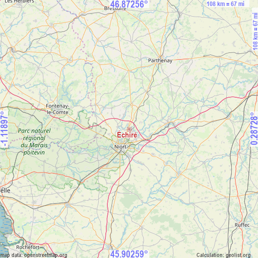
Échiré GPS coordinates[2]
46° 23' 23.028" North, 0° 24' 57.024" West
| Map corner | latitude | longitude |
|---|---|---|
| Upper-left | 46.87256°, | -1.11897° |
| Center: | 46.38973°, | -0.41584° |
| Lower-right: | 45.90259°, | 0.28728° |
| Map W x H: | 107.9×107.8 km | = 67×67mi |
| max Lat: | 51.07786° ⇑61.2% North |
| Échiré: | 46.38973° |
| min Lat: | ⇓38.8% South 41.3874° |
| min Long | Échiré | max Long |
| -5.08615° | -0.41584° | 9.52242° |
| W 17.7%⇐ | ⇒82.3% E |
Elevation
Elevation of Échiré is 50 m = 164 ft, and this is 143.7 m = 471 ft below average elevation for this country.
| Max E: |
2333 m = 7654 ft | 81.8% |
| Avg. | 193.7 m = 635 ft | |
| Échiré | 50 m = 164 ft | |
Min E: |
-1 m = -3 ft | 18.2% |
See also: France elevation on elevation.city.
Geographical zone
Échiré is located in North temperate zone (between Tropic of Cancer and the Arctic Circle). Distance of this North polar circle is 2243.1 km =1393.8 mi to North.| Distance of | km | miles | from Échiré |
|---|---|---|---|
| North Pole | 4849 | 3013 | to North |
| Arctic Circle | 2243.1 | 1393.8 | to North |
| Tropic Cancer | 2552.1 | 1585.8 | to South |
| Equator | 5158.1 | 3205.1 | to South |


Nearby cities:
15 places around Échiré: (largest is in red/bold)
• Champdeniers-Saint-Denis
10.5 km =6.5 mi,  6°
6°
• Chauray
4.4 km =2.7 mi,  137°
137°
• Cherveux
5.3 km =3.3 mi,  57°
57°
• François
5.7 km =3.5 mi,  111°
111°
• Germond-Rouvre
6.7 km =4.2 mi,  359°
359°
• La Crèche
9.2 km =5.7 mi, 106°
• Niort
8.1 km =5 mi,  203°
203°
• Saint-Gelais
2.1 km =1.3 mi, 110°
• Saint-Maxire
4.9 km =3 mi,  282°
282°
• Saint-Rémy
8.8 km =5.5 mi,  256°
256°
• Sainte-Ouenne
6.5 km =4 mi,  339°
339°
• Sciecq
4.6 km =2.9 mi,  246°
246°
• Surin
8.7 km =5.4 mi, 335°
• Villiers-en-Plaine
9.6 km =6 mi, 282°
• Vouillé
9.1 km =5.7 mi,  156°
156°
Sources, notices
• [Note1] Compared only with cities in France existing in our database
• [Src1] Map data: © OpenStreetMap contributors (CC-BY-SA)
• [Src2] Other city data from geonames.org with taken over terms of usage.
• [Src3] Geographical zone / Annual Mean Temperature by Robert A. Rohde @ Wikipedia
