Neufchâtel-sur-Aisne geodata
Neufchâtel-sur-Aisne (Hauts-de-France) is a populated place; located in France in Europe/Paris (GMT+2) time zone. With population of 506 people, there are 15128 cities with bigger population in this country. Compared to other cities in France, 88.3% of cities are located further ↓South; 68.2% of cities are located further ←West and 78.6% of cities have higher elevation than Neufchâtel-sur-Aisne. Note1
Administrative division(s):
- Level 1: Hauts-de-France
- Level 2: Département de l'Aisne
- Level 3: Arrondissement de Laon
- Level 4: Neufchâtel-sur-Aisne


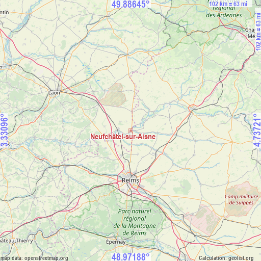
Neufchâtel-sur-Aisne GPS coordinates[2]
49° 25' 52.68" North, 4° 2' 2.724" East
| Map corner | latitude | longitude |
|---|---|---|
| Upper-left | 49.88645°, | 3.33096° |
| Center: | 49.4313°, | 4.03409° |
| Lower-right: | 48.97188°, | 4.73721° |
| Map W x H: | 101.7×101.7 km | = 63.2×63.2mi |
| max Lat: | 51.07786° ⇑11.7% North |
| Neufchâtel-sur-Aisne: | 49.4313° |
| min Lat: | ⇓88.3% South 41.3874° |
| min Long | Neufchâtel-sur | max Long |
| -5.08615° | 4.03409° | 9.52242° |
| W 68.2%⇐ | ⇒31.8% E |
Elevation
Elevation of Neufchâtel-sur-Aisne is 58 m = 190 ft, and this is 135.7 m = 445 ft below average elevation for this country.
| Max E: |
2333 m = 7654 ft | 78.6% |
| Avg. | 193.7 m = 635 ft | |
| Neufchâtel-sur-Aisne | 58 m = 190 ft | |
Min E: |
-1 m = -3 ft | 21.4% |
See also: France elevation on elevation.city.
Geographical zone
Neufchâtel-sur-Aisne is located in North temperate zone (between Tropic of Cancer and the Arctic Circle). Distance of this North polar circle is 1904.9 km =1183.6 mi to North.| Distance of | km | miles | from Neufchâtel-sur-Aisne |
|---|---|---|---|
| North Pole | 4510.8 | 2802.9 | to North |
| Arctic Circle | 1904.9 | 1183.6 | to North |
| Tropic Cancer | 2890.3 | 1795.9 | to South |
| Equator | 5496.2 | 3415.2 | to South |


Nearby cities:
15 places around Neufchâtel-sur-Aisne: (largest is in red/bold)
• Asfeld
7.4 km =4.6 mi,  54°
54°
• Auménancourt-le-Petit
6.4 km =4 mi,  163°
163°
• Bazancourt
12.3 km =7.6 mi,  126°
126°
• Berry-au-Bac
10.1 km =6.3 mi,  252°
252°
• Boult-sur-Suippe
10.5 km =6.5 mi, 129°
• Bourgogne
9.5 km =5.9 mi, 163°
• Cormicy
12.1 km =7.5 mi,  236°
236°
• Courcy
12.2 km =7.6 mi,  190°
190°
• Guignicourt
4.9 km =3 mi,  277°
277°
• Hermonville
13.8 km =8.6 mi,  220°
220°
• Isles-sur-Suippe
14.7 km =9.1 mi,  124°
124°
• Loivre
10.2 km =6.3 mi,  202°
202°
• Saint-Germainmont
11.1 km =6.9 mi,  39°
39°
• Saint-Thierry
14.8 km =9.2 mi, 199°
• Évergnicourt
1.4 km =0.9 mi,  19°
19°
Sources, notices
• [Note1] Compared only with cities in France existing in our database
• [Src1] Map data: © OpenStreetMap contributors (CC-BY-SA)
• [Src2] Other city data from geonames.org with taken over terms of usage.
• [Src3] Geographical zone / Annual Mean Temperature by Robert A. Rohde @ Wikipedia
