Navarrenx geodata
Navarrenx (Nouvelle-Aquitaine) is a populated place; located in France in Europe/Paris (GMT+2) time zone. With population of 1,275 people, there are 7150 cities with bigger population in this country. Compared to other cities in France, 95.2% of cities are located further ↑North; 86.1% of cities are located further →East and 50.9% of cities have higher elevation than Navarrenx. Note1
Administrative division(s):
- Level 1: Nouvelle-Aquitaine
- Level 2: Département des Pyrénées-Atlantiques
- Level 3: Oloron-Sainte-Marie
- Level 4: Navarrenx


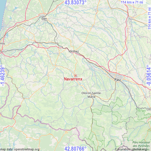
Navarrenx GPS coordinates[2]
43° 19' 16.86" North, 0° 45' 33.372" West
| Map corner | latitude | longitude |
|---|---|---|
| Upper-left | 43.83073°, | -1.46239° |
| Center: | 43.32135°, | -0.75927° |
| Lower-right: | 42.80766°, | -0.05614° |
| Map W x H: | 113.8×113.8 km | = 70.7×70.7mi |
| max Lat: | 51.07786° ⇑95.2% North |
| Navarrenx: | 43.32135° |
| min Lat: | ⇓4.8% South 41.3874° |
| min Long | Navarrenx | max Long |
| -5.08615° | -0.75927° | 9.52242° |
| W 13.9%⇐ | ⇒86.1% E |
Elevation
Elevation of Navarrenx is 129 m = 423 ft, and this is 64.7 m = 212 ft below average elevation for this country.
| Max E: |
2333 m = 7654 ft | 50.9% |
| Avg. | 193.7 m = 635 ft | |
| Navarrenx | 129 m = 423 ft | |
Min E: |
-1 m = -3 ft | 49.1% |
See also: France elevation on elevation.city.
Geographical zone
Navarrenx is located in North temperate zone (between Tropic of Cancer and the Arctic Circle). Distance of this Northern Tropic circle is 2211 km =1373.9 mi to South.| Distance of | km | miles | from Navarrenx |
|---|---|---|---|
| North Pole | 5190.2 | 3225 | to North |
| Arctic Circle | 2584.3 | 1605.8 | to North |
| Tropic Cancer | 2211 | 1373.9 | to South |
| Equator | 4816.9 | 2993.1 | to South |


Nearby cities:
15 places around Navarrenx: (largest is in red/bold)
• Barcus
14.7 km =9.1 mi,  183°
183°
• Chéraute
13.4 km =8.3 mi,  221°
221°
• Espès-Undurein
11.7 km =7.3 mi,  238°
238°
• Esquiule
13.9 km =8.6 mi,  165°
165°
• Lacq
14.7 km =9.1 mi,  43°
43°
• Lagor
11.2 km =7 mi,  52°
52°
• Lahourcade
12 km =7.5 mi,  74°
74°
• Lucq-de-Béarn
7.9 km =4.9 mi,  107°
107°
• Maslacq
13.3 km =8.3 mi,  21°
21°
• Mauléon-Licharre
14.4 km =8.9 mi, 223°
• Monein
14.3 km =8.9 mi,  84°
84°
• Moumour
13.8 km =8.6 mi,  147°
147°
• Mourenx
14.6 km =9.1 mi,  61°
61°
• Pardies
15.1 km =9.4 mi, 70°
• Viodos-Abense-de-Bas
13.2 km =8.2 mi,  227°
227°
Sources, notices
• [Note1] Compared only with cities in France existing in our database
• [Src1] Map data: © OpenStreetMap contributors (CC-BY-SA)
• [Src2] Other city data from geonames.org with taken over terms of usage.
• [Src3] Geographical zone / Annual Mean Temperature by Robert A. Rohde @ Wikipedia
