Mauléon-Licharre geodata
Mauléon-Licharre (Nouvelle-Aquitaine) is a populated place; located in France in Europe/Paris (GMT+2) time zone. With population of 3,313 people, there are 2945 cities with bigger population in this country. Compared to other cities in France, 96.8% of cities are located further ↑North; 87.1% of cities are located further →East and 50.8% of cities have lower elevation than Mauléon-Licharre. Note1
Administrative division(s):
- Level 1: Nouvelle-Aquitaine
- Level 2: Département des Pyrénées-Atlantiques
- Level 3: Oloron-Sainte-Marie
- Level 4: Mauléon-Licharre


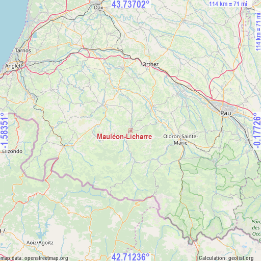
Mauléon-Licharre GPS coordinates[2]
43° 13' 36.624" North, 0° 52' 49.368" West
| Map corner | latitude | longitude |
|---|---|---|
| Upper-left | 43.73702°, | -1.58351° |
| Center: | 43.22684°, | -0.88038° |
| Lower-right: | 42.71236°, | -0.17726° |
| Map W x H: | 113.9×113.9 km | = 70.8×70.8mi |
| max Lat: | 51.07786° ⇑96.8% North |
| Mauléon-Licharre: | 43.22684° |
| min Lat: | ⇓3.2% South 41.3874° |
| min Long | Mauléon-Lichar | max Long |
| -5.08615° | -0.88038° | 9.52242° |
| W 12.9%⇐ | ⇒87.1% E |
Elevation
Elevation of Mauléon-Licharre is 135 m = 443 ft, and this is 58.7 m = 193 ft below average elevation for this country.
| Max E: |
2333 m = 7654 ft | 49.2% |
| Avg. | 193.7 m = 635 ft | |
| Mauléon-Licharre | 135 m = 443 ft | |
Min E: |
-1 m = -3 ft | 50.8% |
See also: France elevation on elevation.city.
Geographical zone
Mauléon-Licharre is located in North temperate zone (between Tropic of Cancer and the Arctic Circle). Distance of this Northern Tropic circle is 2200.5 km =1367.3 mi to South.| Distance of | km | miles | from Mauléon-Licharre |
|---|---|---|---|
| North Pole | 5200.7 | 3231.6 | to North |
| Arctic Circle | 2594.8 | 1612.3 | to North |
| Tropic Cancer | 2200.5 | 1367.3 | to South |
| Equator | 4806.4 | 2986.6 | to South |


Nearby cities:
15 places around Mauléon-Licharre: (largest is in red/bold)
• Aramits
18.1 km =11.2 mi,  132°
132°
• Aïcirits-Camou-Suhast
16.8 km =10.4 mi,  316°
316°
• Barcus
9.9 km =6.2 mi,  114°
114°
• Beyrie-sur-Joyeuse
18.1 km =11.2 mi,  303°
303°
• Chéraute
1.1 km =0.7 mi,  64°
64°
• Espès-Undurein
4.4 km =2.7 mi,  356°
356°
• Esquiule
13.6 km =8.5 mi,  102°
102°
• Garindein
2.8 km =1.7 mi,  226°
226°
• Gotein-Libarrenx
4.4 km =2.7 mi,  201°
201°
• Moumour
17.4 km =10.8 mi,  93°
93°
• Navarrenx
14.4 km =8.9 mi,  43°
43°
• Ordiarp
6.8 km =4.2 mi, 229°
• Saint-Palais
16.8 km =10.4 mi,  312°
312°
• Tardets-Sorholus
12.2 km =7.6 mi,  173°
173°
• Viodos-Abense-de-Bas
1.7 km =1.1 mi, 359°
In other languages:
- In Spanish: Mauleón, Mauleón-Licharre
- In Russian: Молеон-Лишар
- In Chinese: 莫莱翁利沙尔
Sources, notices
• [Note1] Compared only with cities in France existing in our database
• [Src1] Map data: © OpenStreetMap contributors (CC-BY-SA)
• [Src2] Other city data from geonames.org with taken over terms of usage.
• [Src3] Geographical zone / Annual Mean Temperature by Robert A. Rohde @ Wikipedia
