Myans geodata
Myans (Auvergne-Rhône-Alpes) is a populated place; located in France in Europe/Paris (GMT+2) time zone. With population of 966 people, there are 9087 cities with bigger population in this country. Compared to other cities in France, 74% of cities are located further ↑North; 87% of cities are located further ←West and 80.3% of cities have lower elevation than Myans. Note1
Administrative division(s):
- Level 1: Auvergne-Rhône-Alpes
- Level 2: Savoie
- Level 3: Arrondissement de Chambéry
- Level 4: Myans


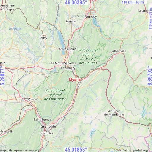
Myans GPS coordinates[2]
45° 30' 48.24" North, 5° 59' 38.04" East
| Map corner | latitude | longitude |
|---|---|---|
| Upper-left | 46.00395°, | 5.29077° |
| Center: | 45.5134°, | 5.9939° |
| Lower-right: | 45.01853°, | 6.69702° |
| Map W x H: | 109.6×109.6 km | = 68.1×68.1mi |
| max Lat: | 51.07786° ⇑74% North |
| Myans: | 45.5134° |
| min Lat: | ⇓26% South 41.3874° |
| min Long | Myans | max Long |
| -5.08615° | 5.9939° | 9.52242° |
| W 87%⇐ | ⇒13% E |
Elevation
Elevation of Myans is 293 m = 961 ft, and this is 99.3 m = 326 ft above average elevation for this country.
| Max E: |
2333 m = 7654 ft | 19.7% |
| Myans | 293 m 961 ft | |
| Avg. | 193.7 m = 635 ft | |
Min E: |
-1 m = -3 ft | 80.3% |
See also: France elevation on elevation.city.
Geographical zone
Myans is located in North temperate zone (between Tropic of Cancer and the Arctic Circle). Distance of this North polar circle is 2340.6 km =1454.4 mi to North.| Distance of | km | miles | from Myans |
|---|---|---|---|
| North Pole | 4946.4 | 3073.5 | to North |
| Arctic Circle | 2340.6 | 1454.4 | to North |
| Tropic Cancer | 2454.7 | 1525.3 | to South |
| Equator | 5060.6 | 3144.5 | to South |


Nearby cities:
15 places around Myans: (largest is in red/bold)
• Apremont
3.7 km =2.3 mi,  246°
246°
• Arbin
6 km =3.7 mi,  91°
91°
• Barberaz
6.7 km =4.2 mi,  323°
323°
• Barby
6.2 km =3.9 mi,  349°
349°
• Challes-les-Eaux
3.9 km =2.4 mi,  344°
344°
• Chapareillan
5.4 km =3.4 mi,  181°
181°
• Chignin
1.9 km =1.2 mi,  51°
51°
• Curienne
6 km =3.7 mi,  10°
10°
• Francin
3.5 km =2.2 mi,  116°
116°
• La Ravoire
6.1 km =3.8 mi,  333°
333°
• Les Marches
1.6 km =1 mi,  151°
151°
• Montmélian
5 km =3.1 mi,  100°
100°
• Saint-Baldoph
3.8 km =2.4 mi,  301°
301°
• Saint-Jeoire-Prieuré
1.8 km =1.1 mi, 349°
• Sainte-Hélène-du-Lac
6.5 km =4 mi, 121°
Sources, notices
• [Note1] Compared only with cities in France existing in our database
• [Src1] Map data: © OpenStreetMap contributors (CC-BY-SA)
• [Src2] Other city data from geonames.org with taken over terms of usage.
• [Src3] Geographical zone / Annual Mean Temperature by Robert A. Rohde @ Wikipedia
