Moussoulens geodata
Moussoulens (Occitanie) is a populated place; located in France in Europe/Paris (GMT+2) time zone. With population of 800 people, there are 10613 cities with bigger population in this country. Compared to other cities in France, 96.2% of cities are located further ↑North; 53.9% of cities are located further →East and 61.5% of cities have lower elevation than Moussoulens. Note1
Administrative division(s):
- Level 1: Occitanie
- Level 2: Département de l'Aude
- Level 3: Arrondissement de Carcassonne
- Level 4: Moussoulens


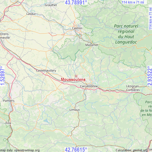
Moussoulens GPS coordinates[2]
43° 16' 48.648" North, 2° 13' 55.524" East
| Map corner | latitude | longitude |
|---|---|---|
| Upper-left | 43.78991°, | 1.52897° |
| Center: | 43.28018°, | 2.23209° |
| Lower-right: | 42.76615°, | 2.93522° |
| Map W x H: | 113.8×113.8 km | = 70.7×70.7mi |
| max Lat: | 51.07786° ⇑96.2% North |
| Moussoulens: | 43.28018° |
| min Lat: | ⇓3.8% South 41.3874° |
| min Long | Moussoulens | max Long |
| -5.08615° | 2.23209° | 9.52242° |
| W 46.1%⇐ | ⇒53.9% E |
Elevation
Elevation of Moussoulens is 177 m = 581 ft, and this is 16.7 m = 55 ft below average elevation for this country.
| Max E: |
2333 m = 7654 ft | 38.5% |
| Avg. | 193.7 m = 635 ft | |
| Moussoulens | 177 m = 581 ft | |
Min E: |
-1 m = -3 ft | 61.5% |
See also: France elevation on elevation.city.
Geographical zone
Moussoulens is located in North temperate zone (between Tropic of Cancer and the Arctic Circle). Distance of this Northern Tropic circle is 2206.4 km =1371 mi to South.| Distance of | km | miles | from Moussoulens |
|---|---|---|---|
| North Pole | 5194.8 | 3227.9 | to North |
| Arctic Circle | 2588.9 | 1608.7 | to North |
| Tropic Cancer | 2206.4 | 1371 | to South |
| Equator | 4812.3 | 2990.2 | to South |


Nearby cities:
15 places around Moussoulens: (largest is in red/bold)
• Alairac
10.6 km =6.6 mi,  175°
175°
• Alzonne
5.3 km =3.3 mi,  235°
235°
• Arzens
9.3 km =5.8 mi,  191°
191°
• Bram
10.4 km =6.5 mi,  247°
247°
• Caux-et-Sauzens
6.4 km =4 mi,  162°
162°
• Cuxac-Cabardès
10.9 km =6.8 mi,  22°
22°
• Lavalette
11.1 km =6.9 mi, 164°
• Montolieu
3.6 km =2.2 mi,  337°
337°
• Pennautier
8 km =5 mi,  119°
119°
• Pezens
4.1 km =2.5 mi,  133°
133°
• Saissac
10.3 km =6.4 mi,  330°
330°
• Ventenac-Cabardès
4.5 km =2.8 mi,  109°
109°
• Villegailhenc
10 km =6.2 mi,  97°
97°
• Villemoustaussou
11.3 km =7 mi, 106°
• Villesèquelande
5.2 km =3.2 mi, 178°
Sources, notices
• [Note1] Compared only with cities in France existing in our database
• [Src1] Map data: © OpenStreetMap contributors (CC-BY-SA)
• [Src2] Other city data from geonames.org with taken over terms of usage.
• [Src3] Geographical zone / Annual Mean Temperature by Robert A. Rohde @ Wikipedia
