Mortcerf geodata
Mortcerf (Île-de-France) is a populated place; located in France in Europe/Paris (GMT+2) time zone. With population of 1,427 people, there are 6496 cities with bigger population in this country. Compared to other cities in France, 75.3% of cities are located further ↓South; 56.6% of cities are located further ←West and 52.6% of cities have higher elevation than Mortcerf. Note1
Administrative division(s):
- Level 1: Île-de-France
- Level 2: Seine-et-Marne
- Level 3: Arrondissement de Provins
- Level 4: Mortcerf


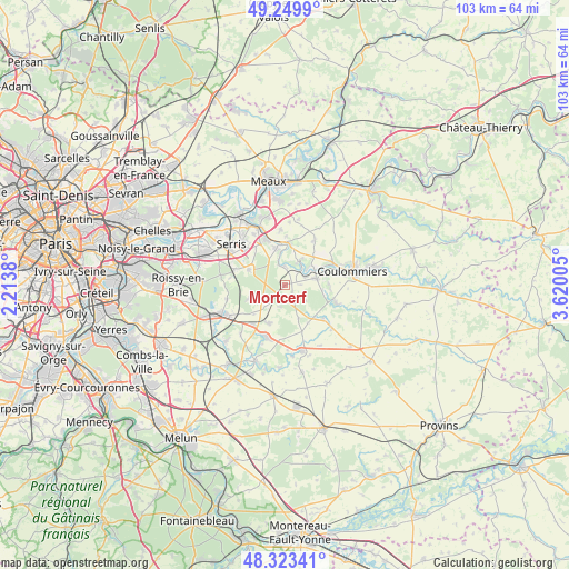
Mortcerf GPS coordinates[2]
48° 47' 19.644" North, 2° 55' 0.912" East
| Map corner | latitude | longitude |
|---|---|---|
| Upper-left | 49.2499°, | 2.2138° |
| Center: | 48.78879°, | 2.91692° |
| Lower-right: | 48.32341°, | 3.62005° |
| Map W x H: | 103×103 km | = 64×64mi |
| max Lat: | 51.07786° ⇑24.7% North |
| Mortcerf: | 48.78879° |
| min Lat: | ⇓75.3% South 41.3874° |
| min Long | Mortcerf | max Long |
| -5.08615° | 2.91692° | 9.52242° |
| W 56.6%⇐ | ⇒43.4% E |
Elevation
Elevation of Mortcerf is 123 m = 404 ft, and this is 70.7 m = 232 ft below average elevation for this country.
| Max E: |
2333 m = 7654 ft | 52.6% |
| Avg. | 193.7 m = 635 ft | |
| Mortcerf | 123 m = 404 ft | |
Min E: |
-1 m = -3 ft | 47.4% |
See also: France elevation on elevation.city.
Geographical zone
Mortcerf is located in North temperate zone (between Tropic of Cancer and the Arctic Circle). Distance of this North polar circle is 1976.4 km =1228.1 mi to North.| Distance of | km | miles | from Mortcerf |
|---|---|---|---|
| North Pole | 4582.3 | 2847.3 | to North |
| Arctic Circle | 1976.4 | 1228.1 | to North |
| Tropic Cancer | 2818.9 | 1751.6 | to South |
| Equator | 5424.8 | 3370.8 | to South |


Nearby cities:
15 places around Mortcerf: (largest is in red/bold)
• Dammartin-sur-Tigeaux
3.4 km =2.1 mi,  2°
2°
• Faremoutiers
5.9 km =3.7 mi,  78°
78°
• Guérard
4.7 km =2.9 mi,  41°
41°
• La Celle-sur-Morin
4.6 km =2.9 mi,  56°
56°
• La Chapelle-sur-Crécy
7.8 km =4.8 mi, 4°
• La Houssaye-en-Brie
5.4 km =3.4 mi,  224°
224°
• Lumigny-Nesles-Ormeaux
6.6 km =4.1 mi,  158°
158°
• Marles-en-Brie
7.3 km =4.5 mi,  201°
201°
• Neufmoutiers-en-Brie
6.6 km =4.1 mi,  250°
250°
• Pommeuse
7.9 km =4.9 mi,  67°
67°
• Saint-Augustin
8.3 km =5.2 mi,  94°
94°
• Touquin
9.2 km =5.7 mi,  130°
130°
• Villeneuve-le-Comte
7 km =4.3 mi,  293°
293°
• Villiers-sur-Morin
8.5 km =5.3 mi,  340°
340°
• Voulangis
7.3 km =4.5 mi,  347°
347°
Sources, notices
• [Note1] Compared only with cities in France existing in our database
• [Src1] Map data: © OpenStreetMap contributors (CC-BY-SA)
• [Src2] Other city data from geonames.org with taken over terms of usage.
• [Src3] Geographical zone / Annual Mean Temperature by Robert A. Rohde @ Wikipedia
