Saint-Augustin geodata
Saint-Augustin (Île-de-France) is a populated place; located in France in Europe/Paris (GMT+2) time zone. With population of 1,545 people, there are 6031 cities with bigger population in this country. Compared to other cities in France, 75.1% of cities are located further ↓South; 58.2% of cities are located further ←West and 52.6% of cities have higher elevation than Saint-Augustin. Note1
Administrative division(s):
- Level 1: Île-de-France
- Level 2: Seine-et-Marne
- Level 3: Arrondissement de Meaux
- Level 4: Saint-Augustin


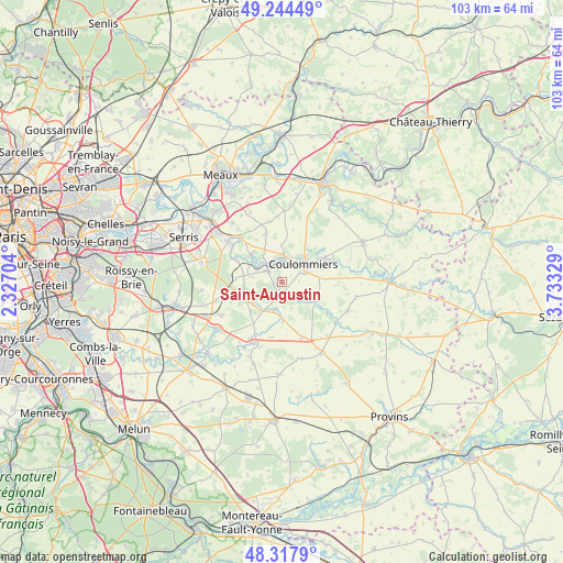
Saint-Augustin GPS coordinates[2]
48° 46' 59.988" North, 3° 1' 48.576" East
| Map corner | latitude | longitude |
|---|---|---|
| Upper-left | 49.24449°, | 2.32704° |
| Center: | 48.78333°, | 3.03016° |
| Lower-right: | 48.3179°, | 3.73329° |
| Map W x H: | 103×103 km | = 64×64mi |
| max Lat: | 51.07786° ⇑24.9% North |
| Saint-Augustin: | 48.78333° |
| min Lat: | ⇓75.1% South 41.3874° |
| min Long | Saint-Augustin | max Long |
| -5.08615° | 3.03016° | 9.52242° |
| W 58.2%⇐ | ⇒41.8% E |
Elevation
Elevation of Saint-Augustin is 123 m = 404 ft, and this is 70.7 m = 232 ft below average elevation for this country.
| Max E: |
2333 m = 7654 ft | 52.6% |
| Avg. | 193.7 m = 635 ft | |
| Saint-Augustin | 123 m = 404 ft | |
Min E: |
-1 m = -3 ft | 47.4% |
See also: France elevation on elevation.city.
Geographical zone
Saint-Augustin is located in North temperate zone (between Tropic of Cancer and the Arctic Circle). Distance of this North polar circle is 1977 km =1228.5 mi to North.| Distance of | km | miles | from Saint-Augustin |
|---|---|---|---|
| North Pole | 4582.9 | 2847.7 | to North |
| Arctic Circle | 1977 | 1228.5 | to North |
| Tropic Cancer | 2818.3 | 1751.2 | to South |
| Equator | 5424.2 | 3370.4 | to South |


Nearby cities:
15 places around Saint-Augustin: (largest is in red/bold)
• Amillis
8.6 km =5.3 mi,  123°
123°
• Beautheil
4.8 km =3 mi, 118°
• Boissy-le-Châtel
8.8 km =5.5 mi,  61°
61°
• Chailly-en-Brie
7 km =4.3 mi,  83°
83°
• Coulommiers
5.3 km =3.3 mi,  49°
49°
• Dammartin-sur-Tigeaux
9.1 km =5.7 mi,  296°
296°
• Faremoutiers
3.1 km =1.9 mi,  305°
305°
• Guérard
6.6 km =4.1 mi, 308°
• La Celle-sur-Morin
5.5 km =3.4 mi, 305°
• Lumigny-Nesles-Ormeaux
8.1 km =5 mi,  226°
226°
• Mortcerf
8.3 km =5.2 mi,  274°
274°
• Mouroux
4.4 km =2.7 mi,  8°
8°
• Pommeuse
3.8 km =2.4 mi,  345°
345°
• Saints
2.8 km =1.7 mi,  154°
154°
• Touquin
5.5 km =3.4 mi,  193°
193°
Sources, notices
• [Note1] Compared only with cities in France existing in our database
• [Src1] Map data: © OpenStreetMap contributors (CC-BY-SA)
• [Src2] Other city data from geonames.org with taken over terms of usage.
• [Src3] Geographical zone / Annual Mean Temperature by Robert A. Rohde @ Wikipedia
