Moroges geodata
Moroges (Bourgogne-Franche-Comté) is a populated place; located in France in Europe/Paris (GMT+2) time zone. With population of 550 people, there are 14213 cities with bigger population in this country. Compared to other cities in France, 57.7% of cities are located further ↑North; 73.5% of cities are located further ←West and 84.3% of cities have lower elevation than Moroges. Note1
Administrative division(s):
- Level 1: Bourgogne-Franche-Comté
- Level 2: Département de Saône-et-Loire
- Level 3: Arrondissement de Chalon-sur-Saône
- Level 4: Moroges


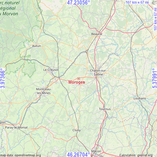
Moroges GPS coordinates[2]
46° 45' 3.42" North, 4° 40' 36.444" East
| Map corner | latitude | longitude |
|---|---|---|
| Upper-left | 47.23056°, | 3.97366° |
| Center: | 46.75095°, | 4.67679° |
| Lower-right: | 46.26704°, | 5.37991° |
| Map W x H: | 107.1×107.1 km | = 66.5×66.5mi |
| max Lat: | 51.07786° ⇑57.7% North |
| Moroges: | 46.75095° |
| min Lat: | ⇓42.3% South 41.3874° |
| min Long | Moroges | max Long |
| -5.08615° | 4.67679° | 9.52242° |
| W 73.5%⇐ | ⇒26.5% E |
Elevation
Elevation of Moroges is 339 m = 1112 ft, and this is 145.3 m = 477 ft above average elevation for this country.
| Max E: |
2333 m = 7654 ft | 15.7% |
| Moroges | 339 m 1112 ft | |
| Avg. | 193.7 m = 635 ft | |
Min E: |
-1 m = -3 ft | 84.3% |
See also: France elevation on elevation.city.
Geographical zone
Moroges is located in North temperate zone (between Tropic of Cancer and the Arctic Circle). Distance of this North polar circle is 2203 km =1368.9 mi to North.| Distance of | km | miles | from Moroges |
|---|---|---|---|
| North Pole | 4808.8 | 2988 | to North |
| Arctic Circle | 2203 | 1368.9 | to North |
| Tropic Cancer | 2592.3 | 1610.8 | to South |
| Equator | 5198.2 | 3230 | to South |


Nearby cities:
15 places around Moroges: (largest is in red/bold)
• Buxy
4.6 km =2.9 mi,  153°
153°
• Châtenoy-le-Royal
11.5 km =7.1 mi,  63°
63°
• Dracy-le-Fort
8.3 km =5.2 mi,  51°
51°
• Farges-lès-Chalon
13.6 km =8.5 mi, 47°
• Fontaines
13 km =8.1 mi,  33°
33°
• Givry
6.1 km =3.8 mi, 55°
• La Charmée
9.7 km =6 mi,  110°
110°
• Mellecey
7.7 km =4.8 mi, 30°
• Mercurey
10.4 km =6.5 mi,  17°
17°
• Messey-sur-Grosne
12.9 km =8 mi,  156°
156°
• Saint-Désert
2.6 km =1.6 mi,  81°
81°
• Saint-Léger-sur-Dheune
11 km =6.8 mi,  343°
343°
• Saint-Rémy
12.5 km =7.8 mi, 83°
• Sevrey
12.5 km =7.8 mi,  96°
96°
• Écuisses
10.6 km =6.6 mi,  273°
273°
Sources, notices
• [Note1] Compared only with cities in France existing in our database
• [Src1] Map data: © OpenStreetMap contributors (CC-BY-SA)
• [Src2] Other city data from geonames.org with taken over terms of usage.
• [Src3] Geographical zone / Annual Mean Temperature by Robert A. Rohde @ Wikipedia
