Ferrals-les-Corbières geodata
Ferrals-les-Corbières (Occitanie) is a populated place; located in France in Europe/Paris (GMT+2) time zone. With population of 1,071 people, there are 8327 cities with bigger population in this country. Compared to other cities in France, 97.6% of cities are located further ↑North; 54% of cities are located further ←West and 74.6% of cities have higher elevation than Ferrals-les-Corbières. Note1
Administrative division(s):
- Level 1: Occitanie
- Level 2: Département de l'Aude
- Level 3: Arrondissement de Narbonne
- Level 4: Ferrals-les-Corbières


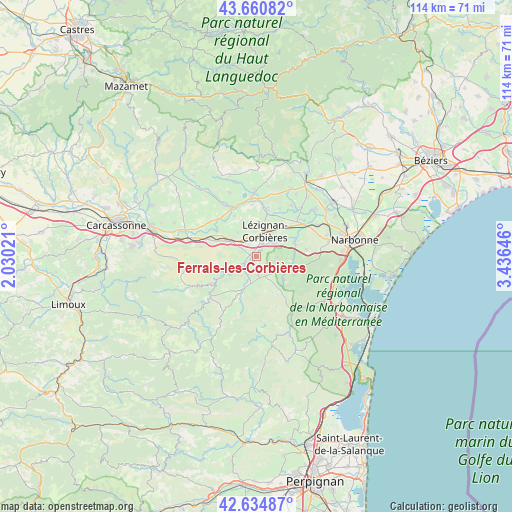
Ferrals-les-Corbières GPS coordinates[2]
43° 9' 0" North, 2° 43' 59.988" East
| Map corner | latitude | longitude |
|---|---|---|
| Upper-left | 43.66082°, | 2.03021° |
| Center: | 43.15°, | 2.73333° |
| Lower-right: | 42.63487°, | 3.43646° |
| Map W x H: | 114.1×114.1 km | = 70.9×70.9mi |
| max Lat: | 51.07786° ⇑97.6% North |
| Ferrals-les-Corbières: | 43.15° |
| min Lat: | ⇓2.4% South 41.3874° |
| min Long | Ferrals-les-Cor | max Long |
| -5.08615° | 2.73333° | 9.52242° |
| W 54%⇐ | ⇒46% E |
Elevation
Elevation of Ferrals-les-Corbières is 68 m = 223 ft, and this is 125.7 m = 412 ft below average elevation for this country.
| Max E: |
2333 m = 7654 ft | 74.6% |
| Avg. | 193.7 m = 635 ft | |
| Ferrals-les-Corbières | 68 m = 223 ft | |
Min E: |
-1 m = -3 ft | 25.4% |
See also: France elevation on elevation.city.
Geographical zone
Ferrals-les-Corbières is located in North temperate zone (between Tropic of Cancer and the Arctic Circle). Distance of this Northern Tropic circle is 2191.9 km =1362 mi to South.| Distance of | km | miles | from Ferrals-les-Corbières |
|---|---|---|---|
| North Pole | 5209.2 | 3236.8 | to North |
| Arctic Circle | 2603.3 | 1617.6 | to North |
| Tropic Cancer | 2191.9 | 1362 | to South |
| Equator | 4797.8 | 2981.2 | to South |


Nearby cities:
15 places around Ferrals-les-Corbières: (largest is in red/bold)
• Bizanet
11.2 km =7 mi,  81°
81°
• Boutenac
4.7 km =2.9 mi,  93°
93°
• Canet
12.7 km =7.9 mi,  47°
47°
• Conilhac-Corbières
4.5 km =2.8 mi,  341°
341°
• Douzens
11.4 km =7.1 mi,  289°
289°
• Fabrezan
3.3 km =2.1 mi,  241°
241°
• Lagrasse
11.3 km =7 mi,  234°
234°
• Luc-sur-Orbieu
5.1 km =3.2 mi, 54°
• Lézignan-Corbières
5.8 km =3.6 mi,  23°
23°
• Moux
7.3 km =4.5 mi,  297°
297°
• Ornaisons
9.1 km =5.7 mi,  68°
68°
• Puicheric
12 km =7.5 mi,  312°
312°
• Saint-André-de-Roquelongue
9.2 km =5.7 mi,  114°
114°
• Saint-Laurent-de-la-Cabrerisse
7.6 km =4.7 mi,  200°
200°
• Thézan-des-Corbières
6.2 km =3.9 mi,  154°
154°
Sources, notices
• [Note1] Compared only with cities in France existing in our database
• [Src1] Map data: © OpenStreetMap contributors (CC-BY-SA)
• [Src2] Other city data from geonames.org with taken over terms of usage.
• [Src3] Geographical zone / Annual Mean Temperature by Robert A. Rohde @ Wikipedia
