Montgiscard geodata
Montgiscard (Occitanie) is a populated place; located in France in Europe/Paris (GMT+2) time zone. With population of 2,207 people, there are 4352 cities with bigger population in this country. Compared to other cities in France, 93.5% of cities are located further ↑North; 62.1% of cities are located further →East and 62.9% of cities have lower elevation than Montgiscard. Note1
Administrative division(s):
- Level 1: Occitanie
- Level 2: Haute-Garonne
- Level 3: Arrondissement de Toulouse
- Level 4: Montgiscard


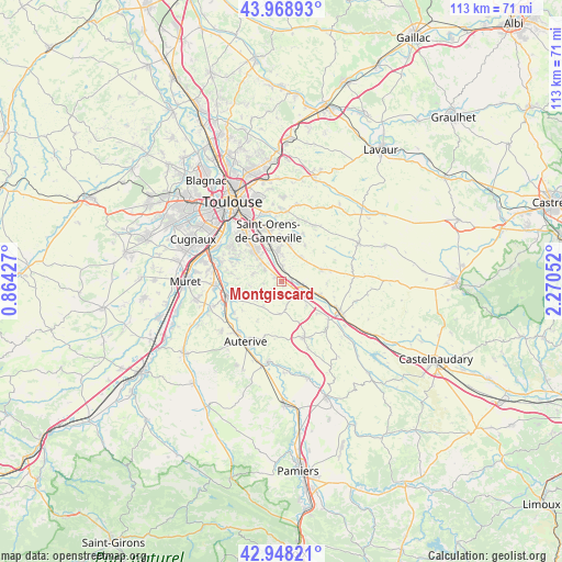
Montgiscard GPS coordinates[2]
43° 27' 38.592" North, 1° 34' 2.604" East
| Map corner | latitude | longitude |
|---|---|---|
| Upper-left | 43.96893°, | 0.86427° |
| Center: | 43.46072°, | 1.56739° |
| Lower-right: | 42.94821°, | 2.27052° |
| Map W x H: | 113.5×113.5 km | = 70.5×70.5mi |
| max Lat: | 51.07786° ⇑93.5% North |
| Montgiscard: | 43.46072° |
| min Lat: | ⇓6.5% South 41.3874° |
| min Long | Montgiscard | max Long |
| -5.08615° | 1.56739° | 9.52242° |
| W 37.9%⇐ | ⇒62.1% E |
Elevation
Elevation of Montgiscard is 184 m = 604 ft, and this is 9.7 m = 32 ft below average elevation for this country.
| Max E: |
2333 m = 7654 ft | 37.1% |
| Avg. | 193.7 m = 635 ft | |
| Montgiscard | 184 m = 604 ft | |
Min E: |
-1 m = -3 ft | 62.9% |
See also: France elevation on elevation.city.
Geographical zone
Montgiscard is located in North temperate zone (between Tropic of Cancer and the Arctic Circle). Distance of this Northern Tropic circle is 2226.5 km =1383.5 mi to South.| Distance of | km | miles | from Montgiscard |
|---|---|---|---|
| North Pole | 5174.7 | 3215.4 | to North |
| Arctic Circle | 2568.8 | 1596.2 | to North |
| Tropic Cancer | 2226.5 | 1383.5 | to South |
| Equator | 4832.4 | 3002.7 | to South |


Nearby cities:
15 places around Montgiscard: (largest is in red/bold)
• Ayguesvives
3.5 km =2.2 mi,  140°
140°
• Baziège
3.8 km =2.4 mi,  100°
100°
• Belberaud
5 km =3.1 mi,  359°
359°
• Corronsac
5.8 km =3.6 mi,  284°
284°
• Deyme
4.1 km =2.5 mi,  304°
304°
• Donneville
1.9 km =1.2 mi,  307°
307°
• Escalquens
6.3 km =3.9 mi,  353°
353°
• Fourquevaux
6.3 km =3.9 mi,  36°
36°
• Montbrun-Lauragais
3.7 km =2.3 mi,  263°
263°
• Montesquieu-Lauragais
7 km =4.3 mi,  134°
134°
• Montlaur
3.2 km =2 mi,  0°
0°
• Odars
7.1 km =4.4 mi,  14°
14°
• Pompertuzat
5.5 km =3.4 mi, 310°
• Péchabou
6.6 km =4.1 mi, 314°
• Saint-Léon
6.7 km =4.2 mi,  184°
184°
Sources, notices
• [Note1] Compared only with cities in France existing in our database
• [Src1] Map data: © OpenStreetMap contributors (CC-BY-SA)
• [Src2] Other city data from geonames.org with taken over terms of usage.
• [Src3] Geographical zone / Annual Mean Temperature by Robert A. Rohde @ Wikipedia
