Montereau-sur-le-Jard geodata
Montereau-sur-le-Jard (Île-de-France) is a populated place; located in France in Europe/Paris (GMT+2) time zone. With population of 616 people, there are 13048 cities with bigger population in this country. Compared to other cities in France, 70.7% of cities are located further ↓South; 53% of cities are located further ←West and 65.6% of cities have higher elevation than Montereau-sur-le-Jard. Note1
Administrative division(s):
- Level 1: Île-de-France
- Level 2: Seine-et-Marne
- Level 3: Arrondissement de Melun
- Level 4: Montereau-sur-le-Jard
Current local time in Montereau-sur-le-Jard:
05:38 AM, SaturdayDifference from your time zone: hours


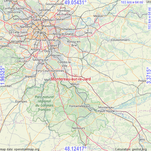
Montereau-sur-le-Jard GPS coordinates[2]
48° 35' 28.968" North, 2° 40' 6.132" East
| Map corner | latitude | longitude |
|---|---|---|
| Upper-left | 49.05431°, | 1.96525° |
| Center: | 48.59138°, | 2.66837° |
| Lower-right: | 48.12417°, | 3.3715° |
| Map W x H: | 103.4×103.4 km | = 64.2×64.2mi |
| max Lat: | 51.07786° ⇑29.3% North |
| Montereau-sur-le-Jard: | 48.59138° |
| min Lat: | ⇓70.7% South 41.3874° |
| min Long | Montereau-sur-l | max Long |
| -5.08615° | 2.66837° | 9.52242° |
| W 53%⇐ | ⇒47% E |
Elevation
Elevation of Montereau-sur-le-Jard is 88 m = 289 ft, and this is 105.7 m = 347 ft below average elevation for this country.
| Max E: |
2333 m = 7654 ft | 65.6% |
| Avg. | 193.7 m = 635 ft | |
| Montereau-sur-le-Jard | 88 m = 289 ft | |
Min E: |
-1 m = -3 ft | 34.4% |
See also: France elevation on elevation.city.
Geographical zone
Montereau-sur-le-Jard is located in North temperate zone (between Tropic of Cancer and the Arctic Circle). Distance of this North polar circle is 1998.3 km =1241.7 mi to North.| Distance of | km | miles | from Montereau-sur-le-Jard |
|---|---|---|---|
| North Pole | 4604.2 | 2860.9 | to North |
| Arctic Circle | 1998.3 | 1241.7 | to North |
| Tropic Cancer | 2796.9 | 1737.9 | to South |
| Equator | 5402.9 | 3357.2 | to South |


Nearby cities:
15 places around Montereau-sur-le-Jard: (largest is in red/bold)
• Cesson
5.5 km =3.4 mi,  233°
233°
• Champdeuil
5.5 km =3.4 mi,  53°
53°
• Crisenoy
5.4 km =3.4 mi,  85°
85°
• Maincy
5.2 km =3.2 mi,  153°
153°
• Melun
5.2 km =3.2 mi,  192°
192°
• Moisenay
5.9 km =3.7 mi,  122°
122°
• Moissy-Cramayel
6.3 km =3.9 mi,  307°
307°
• Rubelles
4.3 km =2.7 mi,  172°
172°
• Réau
3.9 km =2.4 mi,  302°
302°
• Saint-Germain-Laxis
3.3 km =2.1 mi,  108°
108°
• Savigny-le-Temple
6.6 km =4.1 mi,  253°
253°
• Soignolles-en-Brie
7.3 km =4.5 mi,  18°
18°
• Vaux-le-Pénil
7.2 km =4.5 mi, 166°
• Vert-Saint-Denis
4.4 km =2.7 mi, 234°
• Voisenon
2.2 km =1.4 mi, 186°
Sources, notices
• [Note1] Compared only with cities in France existing in our database
• [Src1] Map data: © OpenStreetMap contributors (CC-BY-SA)
• [Src2] Other city data from geonames.org with taken over terms of usage.
• [Src3] Geographical zone / Annual Mean Temperature by Robert A. Rohde @ Wikipedia
