Moissy-Cramayel geodata
Moissy-Cramayel (Île-de-France) is a populated place; located in France in Europe/Paris (GMT+2) time zone. With population of 16,259 people, there are 581 cities with bigger population in this country. Compared to other cities in France, 71.5% of cities are located further ↓South; 52.1% of cities are located further ←West and 64.4% of cities have higher elevation than Moissy-Cramayel. Note1
Administrative division(s):
- Level 1: Île-de-France
- Level 2: Seine-et-Marne
- Level 3: Arrondissement de Melun
- Level 4: Moissy-Cramayel


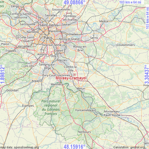
Moissy-Cramayel GPS coordinates[2]
48° 37' 33.78" North, 2° 36' 4.5" East
| Map corner | latitude | longitude |
|---|---|---|
| Upper-left | 49.08866°, | 1.89812° |
| Center: | 48.62605°, | 2.60125° |
| Lower-right: | 48.15916°, | 3.30437° |
| Map W x H: | 103.4×103.3 km | = 64.2×64.2mi |
| max Lat: | 51.07786° ⇑28.5% North |
| Moissy-Cramayel: | 48.62605° |
| min Lat: | ⇓71.5% South 41.3874° |
| min Long | Moissy-Cramayel | max Long |
| -5.08615° | 2.60125° | 9.52242° |
| W 52.1%⇐ | ⇒47.9% E |
Elevation
Elevation of Moissy-Cramayel is 91 m = 299 ft, and this is 102.7 m = 337 ft below average elevation for this country.
| Max E: |
2333 m = 7654 ft | 64.4% |
| Avg. | 193.7 m = 635 ft | |
| Moissy-Cramayel | 91 m = 299 ft | |
Min E: |
-1 m = -3 ft | 35.6% |
See also: France elevation on elevation.city.
Geographical zone
Moissy-Cramayel is located in North temperate zone (between Tropic of Cancer and the Arctic Circle). Distance of this North polar circle is 1994.5 km =1239.3 mi to North.| Distance of | km | miles | from Moissy-Cramayel |
|---|---|---|---|
| North Pole | 4600.4 | 2858.6 | to North |
| Arctic Circle | 1994.5 | 1239.3 | to North |
| Tropic Cancer | 2800.8 | 1740.3 | to South |
| Equator | 5406.7 | 3359.6 | to South |


Nearby cities:
15 places around Moissy-Cramayel: (largest is in red/bold)
• Brie-Comte-Robert
7.4 km =4.6 mi,  5°
5°
• Cesson
7.1 km =4.4 mi,  175°
175°
• Combs-la-Ville
4.9 km =3 mi,  331°
331°
• Lieusaint
4 km =2.5 mi,  283°
283°
• Montereau-sur-le-Jard
6.3 km =3.9 mi,  127°
127°
• Nandy
5.6 km =3.5 mi,  210°
210°
• Quincy-sous-Sénart
7.2 km =4.5 mi,  316°
316°
• Réau
2.4 km =1.5 mi,  136°
136°
• Saint-Pierre-du-Perray
8 km =5 mi,  257°
257°
• Savigny-le-Temple
5.9 km =3.7 mi,  193°
193°
• Soignolles-en-Brie
7.8 km =4.8 mi,  67°
67°
• Tigery
7.1 km =4.4 mi, 284°
• Varennes-Jarcy
6.6 km =4.1 mi, 333°
• Vert-Saint-Denis
6.6 km =4.1 mi,  167°
167°
• Voisenon
7.6 km =4.7 mi, 142°
Sources, notices
• [Note1] Compared only with cities in France existing in our database
• [Src1] Map data: © OpenStreetMap contributors (CC-BY-SA)
• [Src2] Other city data from geonames.org with taken over terms of usage.
• [Src3] Geographical zone / Annual Mean Temperature by Robert A. Rohde @ Wikipedia
