Champdeuil geodata
Champdeuil (Île-de-France) is a populated place; located in France in Europe/Paris (GMT+2) time zone. With population of 723 people, there are 11495 cities with bigger population in this country. Compared to other cities in France, 71.4% of cities are located further ↓South; 53.9% of cities are located further ←West and 63.2% of cities have higher elevation than Champdeuil. Note1
Administrative division(s):
- Level 1: Île-de-France
- Level 2: Seine-et-Marne
- Level 3: Arrondissement de Melun
- Level 4: Champdeuil


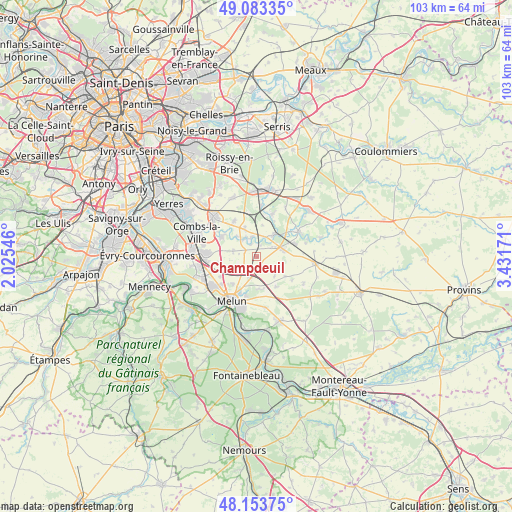
Champdeuil GPS coordinates[2]
48° 37' 14.484" North, 2° 43' 42.924" East
| Map corner | latitude | longitude |
|---|---|---|
| Upper-left | 49.08335°, | 2.02546° |
| Center: | 48.62069°, | 2.72859° |
| Lower-right: | 48.15375°, | 3.43171° |
| Map W x H: | 103.4×103.4 km | = 64.2×64.2mi |
| max Lat: | 51.07786° ⇑28.6% North |
| Champdeuil: | 48.62069° |
| min Lat: | ⇓71.4% South 41.3874° |
| min Long | Champdeuil | max Long |
| -5.08615° | 2.72859° | 9.52242° |
| W 53.9%⇐ | ⇒46.1% E |
Elevation
Elevation of Champdeuil is 94 m = 308 ft, and this is 99.7 m = 327 ft below average elevation for this country.
| Max E: |
2333 m = 7654 ft | 63.2% |
| Avg. | 193.7 m = 635 ft | |
| Champdeuil | 94 m = 308 ft | |
Min E: |
-1 m = -3 ft | 36.8% |
See also: France elevation on elevation.city.
Geographical zone
Champdeuil is located in North temperate zone (between Tropic of Cancer and the Arctic Circle). Distance of this North polar circle is 1995.1 km =1239.7 mi to North.| Distance of | km | miles | from Champdeuil |
|---|---|---|---|
| North Pole | 4600.9 | 2858.9 | to North |
| Arctic Circle | 1995.1 | 1239.7 | to North |
| Tropic Cancer | 2800.2 | 1740 | to South |
| Equator | 5406.1 | 3359.2 | to South |


Nearby cities:
15 places around Champdeuil: (largest is in red/bold)
• Blandy
7.1 km =4.4 mi,  146°
146°
• Champeaux
7 km =4.3 mi,  124°
124°
• Coubert
6.1 km =3.8 mi,  338°
338°
• Crisenoy
3 km =1.9 mi,  160°
160°
• Fouju
5.3 km =3.3 mi,  136°
136°
• Guignes
5.4 km =3.4 mi,  75°
75°
• Moisenay
6.5 km =4 mi,  175°
175°
• Montereau-sur-le-Jard
5.5 km =3.4 mi,  233°
233°
• Ozouer-le-Voulgis
5.5 km =3.4 mi,  37°
37°
• Réau
7.8 km =4.8 mi,  261°
261°
• Saint-Germain-Laxis
4.5 km =2.8 mi,  197°
197°
• Soignolles-en-Brie
4.2 km =2.6 mi,  329°
329°
• Solers
4.4 km =2.7 mi,  347°
347°
• Voisenon
7.2 km =4.5 mi,  220°
220°
• Yèbles
3.4 km =2.1 mi,  58°
58°
Sources, notices
• [Note1] Compared only with cities in France existing in our database
• [Src1] Map data: © OpenStreetMap contributors (CC-BY-SA)
• [Src2] Other city data from geonames.org with taken over terms of usage.
• [Src3] Geographical zone / Annual Mean Temperature by Robert A. Rohde @ Wikipedia
