Montendre geodata
Montendre (Nouvelle-Aquitaine) is a populated place; located in France in Europe/Paris (GMT+2) time zone. With population of 3,413 people, there are 2851 cities with bigger population in this country. Compared to other cities in France, 76.5% of cities are located further ↑North; 82.2% of cities are located further →East and 66.6% of cities have higher elevation than Montendre. Note1
Administrative division(s):
- Level 1: Nouvelle-Aquitaine
- Level 2: Charente-Maritime
- Level 3: Arrondissement de Jonzac
- Level 4: Montendre


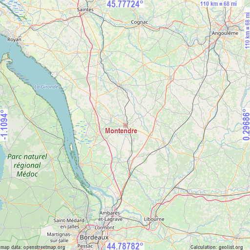
Montendre GPS coordinates[2]
45° 17' 4.884" North, 0° 24' 22.572" West
| Map corner | latitude | longitude |
|---|---|---|
| Upper-left | 45.77724°, | -1.1094° |
| Center: | 45.28469°, | -0.40627° |
| Lower-right: | 44.78782°, | 0.29686° |
| Map W x H: | 110×110 km | = 68.4×68.4mi |
| max Lat: | 51.07786° ⇑76.5% North |
| Montendre: | 45.28469° |
| min Lat: | ⇓23.5% South 41.3874° |
| min Long | Montendre | max Long |
| -5.08615° | -0.40627° | 9.52242° |
| W 17.8%⇐ | ⇒82.2% E |
Elevation
Elevation of Montendre is 86 m = 282 ft, and this is 107.7 m = 353 ft below average elevation for this country.
| Max E: |
2333 m = 7654 ft | 66.6% |
| Avg. | 193.7 m = 635 ft | |
| Montendre | 86 m = 282 ft | |
Min E: |
-1 m = -3 ft | 33.4% |
See also: France elevation on elevation.city.
Geographical zone
Montendre is located in North temperate zone (between Tropic of Cancer and the Arctic Circle). Distance of this North polar circle is 2366 km =1470.2 mi to North.| Distance of | km | miles | from Montendre |
|---|---|---|---|
| North Pole | 4971.9 | 3089.4 | to North |
| Arctic Circle | 2366 | 1470.2 | to North |
| Tropic Cancer | 2429.3 | 1509.5 | to South |
| Equator | 5035.2 | 3128.7 | to South |


Nearby cities:
15 places around Montendre: (largest is in red/bold)
• Bedenac
15.5 km =9.6 mi,  147°
147°
• Boisredon
10.8 km =6.7 mi,  288°
288°
• Bussac-Forêt
8.6 km =5.3 mi,  161°
161°
• Chepniers
9.2 km =5.7 mi,  114°
114°
• Chevanceaux
13.6 km =8.5 mi,  82°
82°
• Donnezac
5.2 km =3.2 mi,  214°
214°
• Marcillac
9.4 km =5.8 mi,  259°
259°
• Montlieu-la-Garde
12.8 km =8 mi, 107°
• Orignolles
14.7 km =9.1 mi, 112°
• Ozillac
12.1 km =7.5 mi,  4°
4°
• Reignac
9.6 km =6 mi,  234°
234°
• Saint-Aubin-de-Blaye
12.2 km =7.6 mi, 260°
• Saint-Savin
15.4 km =9.6 mi,  192°
192°
• Saint-Simon-de-Bordes
12.9 km =8 mi,  342°
342°
• Étauliers
14.6 km =9.1 mi,  243°
243°
Sources, notices
• [Note1] Compared only with cities in France existing in our database
• [Src1] Map data: © OpenStreetMap contributors (CC-BY-SA)
• [Src2] Other city data from geonames.org with taken over terms of usage.
• [Src3] Geographical zone / Annual Mean Temperature by Robert A. Rohde @ Wikipedia
