Moncoutant geodata
Moncoutant (Nouvelle-Aquitaine) is a populated place; located in France in Europe/Paris (GMT+2) time zone. With population of 3,029 people, there are 3216 cities with bigger population in this country. Compared to other cities in France, 58% of cities are located further ↑North; 84.4% of cities are located further →East and 65.6% of cities have lower elevation than Moncoutant. Note1
Administrative division(s):
- Level 1: Nouvelle-Aquitaine
- Level 2: Département des Deux-Sèvres
- Level 3: Arrondissement de Bressuire
- Level 4: Moncoutant-sur-Sèvre


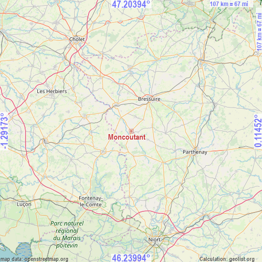
Moncoutant GPS coordinates[2]
46° 43' 26.724" North, 0° 35' 18.996" West
| Map corner | latitude | longitude |
|---|---|---|
| Upper-left | 47.20394°, | -1.29173° |
| Center: | 46.72409°, | -0.58861° |
| Lower-right: | 46.23994°, | 0.11452° |
| Map W x H: | 107.2×107.2 km | = 66.6×66.6mi |
| max Lat: | 51.07786° ⇑58% North |
| Moncoutant: | 46.72409° |
| min Lat: | ⇓42% South 41.3874° |
| min Long | Moncoutant | max Long |
| -5.08615° | -0.58861° | 9.52242° |
| W 15.6%⇐ | ⇒84.4% E |
Elevation
Elevation of Moncoutant is 197 m = 646 ft, and this is 3.3 m = 11 ft above average elevation for this country.
| Max E: |
2333 m = 7654 ft | 34.4% |
| Moncoutant | 197 m 646 ft | |
| Avg. | 193.7 m = 635 ft | |
Min E: |
-1 m = -3 ft | 65.6% |
See also: France elevation on elevation.city.
Geographical zone
Moncoutant is located in North temperate zone (between Tropic of Cancer and the Arctic Circle). Distance of this North polar circle is 2205.9 km =1370.7 mi to North.| Distance of | km | miles | from Moncoutant |
|---|---|---|---|
| North Pole | 4811.8 | 2989.9 | to North |
| Arctic Circle | 2205.9 | 1370.7 | to North |
| Tropic Cancer | 2589.3 | 1608.9 | to South |
| Equator | 5195.2 | 3228.1 | to South |


Nearby cities:
15 places around Moncoutant: (largest is in red/bold)
• Breuil-Barret
10.6 km =6.6 mi,  221°
221°
• Cerizay
12.3 km =7.6 mi,  331°
331°
• Chanteloup
6.8 km =4.2 mi,  46°
46°
• Courlay
6.4 km =4 mi,  14°
14°
• La Chapelle-Saint-Laurent
8.9 km =5.5 mi,  73°
73°
• La Forêt-sur-Sèvre
6.9 km =4.3 mi,  317°
317°
• Largeasse
7.6 km =4.7 mi,  116°
116°
• L’Absie
10.2 km =6.3 mi,  175°
175°
• Menomblet
9.4 km =5.8 mi,  274°
274°
• Moutiers-sous-Chantemerle
3.9 km =2.4 mi, 215°
• Neuvy-Bouin
11.2 km =7 mi, 118°
• Saint-André-sur-Sèvre
9.5 km =5.9 mi,  313°
313°
• Saint-Paul-en-Gâtine
10.4 km =6.5 mi,  191°
191°
• Saint-Pierre-du-Chemin
9.1 km =5.7 mi,  249°
249°
• Vernoux-en-Gâtine
11.4 km =7.1 mi,  149°
149°
Sources, notices
• [Note1] Compared only with cities in France existing in our database
• [Src1] Map data: © OpenStreetMap contributors (CC-BY-SA)
• [Src2] Other city data from geonames.org with taken over terms of usage.
• [Src3] Geographical zone / Annual Mean Temperature by Robert A. Rohde @ Wikipedia
