Cerizay geodata
Cerizay (Nouvelle-Aquitaine) is a populated place; located in France in Europe/Paris (GMT+2) time zone. With population of 4,777 people, there are 2079 cities with bigger population in this country. Compared to other cities in France, 57% of cities are located further ↑North; 85.2% of cities are located further →East and 64% of cities have lower elevation than Cerizay. Note1
Administrative division(s):
- Level 1: Nouvelle-Aquitaine
- Level 2: Département des Deux-Sèvres
- Level 3: Arrondissement de Bressuire
- Level 4: Cerizay


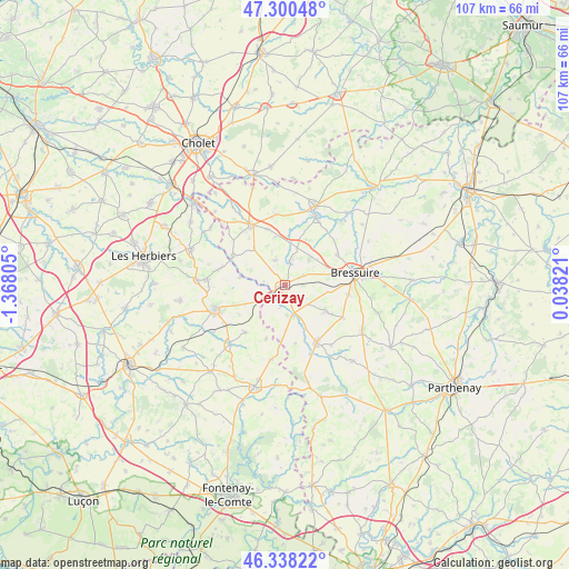
Cerizay GPS coordinates[2]
46° 49' 17.4" North, 0° 39' 53.712" West
| Map corner | latitude | longitude |
|---|---|---|
| Upper-left | 47.30048°, | -1.36805° |
| Center: | 46.8215°, | -0.66492° |
| Lower-right: | 46.33822°, | 0.03821° |
| Map W x H: | 107×107 km | = 66.5×66.5mi |
| max Lat: | 51.07786° ⇑57% North |
| Cerizay: | 46.8215° |
| min Lat: | ⇓43% South 41.3874° |
| min Long | Cerizay | max Long |
| -5.08615° | -0.66492° | 9.52242° |
| W 14.8%⇐ | ⇒85.2% E |
Elevation
Elevation of Cerizay is 189 m = 620 ft, and this is 4.7 m = 15 ft below average elevation for this country.
| Max E: |
2333 m = 7654 ft | 36% |
| Avg. | 193.7 m = 635 ft | |
| Cerizay | 189 m = 620 ft | |
Min E: |
-1 m = -3 ft | 64% |
See also: France elevation on elevation.city.
Geographical zone
Cerizay is located in North temperate zone (between Tropic of Cancer and the Arctic Circle). Distance of this North polar circle is 2195.1 km =1364 mi to North.| Distance of | km | miles | from Cerizay |
|---|---|---|---|
| North Pole | 4801 | 2983.2 | to North |
| Arctic Circle | 2195.1 | 1364 | to North |
| Tropic Cancer | 2600.1 | 1615.6 | to South |
| Equator | 5206.1 | 3234.9 | to South |


Nearby cities:
15 places around Cerizay: (largest is in red/bold)
• Bretignolles
6.4 km =4 mi,  43°
43°
• Chanteloup
12.4 km =7.7 mi,  119°
119°
• Combrand
5.1 km =3.2 mi,  338°
338°
• Courlay
8.8 km =5.5 mi, 122°
• La Forêt-sur-Sèvre
5.9 km =3.7 mi,  168°
168°
• La Petite-Boissière
9.1 km =5.7 mi,  319°
319°
• La Pommeraie-sur-Sèvre
8.7 km =5.4 mi,  280°
280°
• Le Pin
4.7 km =2.9 mi,  9°
9°
• Les Châtelliers-Châteaumur
12.4 km =7.7 mi,  287°
287°
• Menomblet
10.7 km =6.6 mi,  199°
199°
• Moncoutant
12.3 km =7.6 mi,  151°
151°
• Montournais
11.7 km =7.3 mi,  220°
220°
• Saint-Amand-sur-Sèvre
11.3 km =7 mi,  298°
298°
• Saint-André-sur-Sèvre
4.4 km =2.7 mi,  194°
194°
• Saint-Mesmin
6 km =3.7 mi,  239°
239°
Sources, notices
• [Note1] Compared only with cities in France existing in our database
• [Src1] Map data: © OpenStreetMap contributors (CC-BY-SA)
• [Src2] Other city data from geonames.org with taken over terms of usage.
• [Src3] Geographical zone / Annual Mean Temperature by Robert A. Rohde @ Wikipedia
