Moncetz-Longevas geodata
Moncetz-Longevas (Grand Est) is a populated place; located in France in Europe/Paris (GMT+2) time zone. With population of 536 people, there are 14480 cities with bigger population in this country. Compared to other cities in France, 77.8% of cities are located further ↓South; 71.5% of cities are located further ←West and 66% of cities have higher elevation than Moncetz-Longevas. Note1
Administrative division(s):
- Level 1: Grand Est
- Level 2: Marne
- Level 3: Arrondissement de Châlons-en-Champagne
- Level 4: Moncetz-Longevas


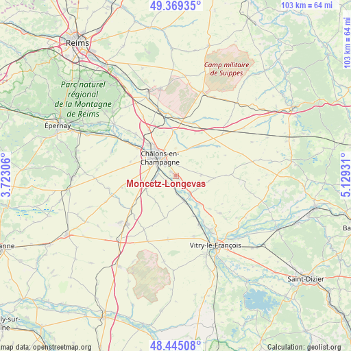
Moncetz-Longevas GPS coordinates[2]
48° 54' 33.66" North, 4° 25' 34.284" East
| Map corner | latitude | longitude |
|---|---|---|
| Upper-left | 49.36935°, | 3.72306° |
| Center: | 48.90935°, | 4.42619° |
| Lower-right: | 48.44508°, | 5.12931° |
| Map W x H: | 102.8×102.8 km | = 63.9×63.9mi |
| max Lat: | 51.07786° ⇑22.2% North |
| Moncetz-Longevas: | 48.90935° |
| min Lat: | ⇓77.8% South 41.3874° |
| min Long | Moncetz-Longeva | max Long |
| -5.08615° | 4.42619° | 9.52242° |
| W 71.5%⇐ | ⇒28.5% E |
Elevation
Elevation of Moncetz-Longevas is 87 m = 285 ft, and this is 106.7 m = 350 ft below average elevation for this country.
| Max E: |
2333 m = 7654 ft | 66% |
| Avg. | 193.7 m = 635 ft | |
| Moncetz-Longevas | 87 m = 285 ft | |
Min E: |
-1 m = -3 ft | 34% |
See also: France elevation on elevation.city.
Geographical zone
Moncetz-Longevas is located in North temperate zone (between Tropic of Cancer and the Arctic Circle). Distance of this North polar circle is 1963 km =1219.8 mi to North.| Distance of | km | miles | from Moncetz-Longevas |
|---|---|---|---|
| North Pole | 4568.9 | 2839 | to North |
| Arctic Circle | 1963 | 1219.8 | to North |
| Tropic Cancer | 2832.3 | 1759.9 | to South |
| Equator | 5438.2 | 3379.1 | to South |


Nearby cities:
15 places around Moncetz-Longevas: (largest is in red/bold)
• Châlons-en-Champagne
6.6 km =4.1 mi,  319°
319°
• Compertrix
6.9 km =4.3 mi,  301°
301°
• Courtisols
10.9 km =6.8 mi,  37°
37°
• Fagnières
10 km =6.2 mi,  307°
307°
• La Chaussée-sur-Marne
11 km =6.8 mi,  139°
139°
• La Veuve
15.6 km =9.7 mi,  329°
329°
• L’Épine
8.3 km =5.2 mi,  23°
23°
• Mairy-sur-Marne
3.3 km =2.1 mi,  199°
199°
• Matougues
16.4 km =10.2 mi, 304°
• Pogny
7.1 km =4.4 mi, 143°
• Recy
12 km =7.5 mi, 317°
• Saint-Germain-la-Ville
3.4 km =2.1 mi,  152°
152°
• Saint-Martin-sur-le-Pré
9.9 km =6.2 mi, 319°
• Saint-Memmie
5.7 km =3.5 mi, 327°
• Sarry
1.8 km =1.1 mi, 304°
Sources, notices
• [Note1] Compared only with cities in France existing in our database
• [Src1] Map data: © OpenStreetMap contributors (CC-BY-SA)
• [Src2] Other city data from geonames.org with taken over terms of usage.
• [Src3] Geographical zone / Annual Mean Temperature by Robert A. Rohde @ Wikipedia
